Köhlerpfad


- 1:27 h
- 5.18 km
- 107 m
- 107 m
- 389 m
- 459 m
- 70 m
- Start: Nature Park hiking car park "Köhlerplatz"
- Destination: Nature Park hiking car park "Köhlerplatz"
With the help of numerous information boards, you will learn about the history of the Wagener charcoal burner family, the structure and function of a charcoal pile, the Hauberg, and the history of charcoal. The tools of the charcoal burner and technical terms from charcoal burning are also clearly explained.
The start and end of this circular hike is the Nature Park hiking car park "Köhlerplatz" on the L719 above Walpersdorf. It leads past a charcoal pile site into the Sieg valley, further into a side valley, and to another charcoal burner’s site with a hut. Passing the edge of Walpersdorf, it goes through the forest back to the starting point.
The Köhlerpfad is marked with the symbol A1. At some intersections, wooden signposts also show you the way. The Köhler quiz provides entertainment during the route. It is available directly at the first information board of the Köhlerpfad. The path is suitable for children from 6 years old. Due to the natural path conditions, an all-terrain stroller is recommended.
Guided tours with a 'real' charcoal burner by arrangement:
Bruno Wagener: 02737 3539
Reinhold Wagener: 02737 5404 or reinhold-wagener@t-online.de
Waypoints


Good to know
Best to visit
Directions
Directly opposite the entrance to the hiking car park is the first information board of the Köhlerpfad. Here you can get the Köhler quiz and a piece of charcoal for writing. You walk down the path into the small hollow, over the playground, and then follow the gravel path at the top. After only a few meters, you will see the charcoal pile site on the right. At the end of the gravel path, you cross the main road L719, keep slightly to the right, and follow the path through the meadow. After 100 m, turn right and initially hike along the edge of the forest until the landscape opens up again.
After 800 m, you reach an asphalt road, where you briefly turn left to read the next information board about the history of the abandoned village Patschoß. Then you walk back along the asphalt path in the direction you came from. At the T-junction, turn left and at the next fork immediately turn right again. Shortly after, keep left and again take the right fork. Now the path leads you along the edge of the Hauberge. At the next two closely following forks, keep left at all times.
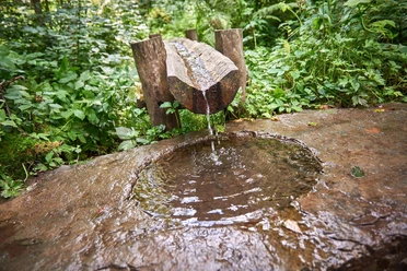
After 500 m, you reach a large fork. You follow the right gravel path and head straight towards a cozy rest area directly by the stream. On the clearing to the left is a second charcoal pile site and a charcoal burner’s hut. At the next forks, always follow the path that now leads you along the top edge of the valley. After 300 m, the path turns to asphalt. You walk downhill slightly and after a further 200 m, turn sharply right.
You follow the path through a short piece of forest and then enter open meadows. You walk along a sheep and goat pasture and at the end of the forks, turn left twice until you come back to an asphalt surface. The path leads you past the sawmill. At the main road, keep right and cross it after 200 m. You follow the road past the Schieferstein through the residential area and, after 300 m, take the right path at the bend. At the end of the housing, the road turns into a forest road, and you enter a beech forest.
At the next forks, follow the path to the right. After 100 m, continue on the left path and turn left again at the next crossing. After 100 m, you will reach a wider forest path at a T-junction. Here, turn right and follow the path. After 900 m, keep right at the fork and pass a barrier. The path now slowly leads you out of the forest; you will see the meadows above the charcoal pile. At the next crossroads, choose the right meadow path. After 100 m, take the left path at the crossing past the last information board down to the hiking car park "Köhlerplatz".
Tour information
Cultural Interesting
Loop Road
Equipment
Sturdy footwear, comfortable and weather-appropriate clothing, provisions, and water.
Directions & Parking facilities
The district of Walpersdorf is located on the L719 and is connected to the A45 via Wilnsdorf. From the A4 and from the Olpe-Süd motorway interchange, there is a connection via the B54 to Siegen. From there, follow the B62 via Dreis-Tiefenbach to Netphen. At the roundabout at the entrance to the town, take the first exit and follow the bypass road L729 to Deuz. Here, follow the L719 through the towns of Grissenbach, Nenkersdorf to Walpersdorf. 1.3 km after leaving Walpersdorf, the hiking car park "Köhlerplatz" is located on the left side in a sharp right-hand bend.
The hiking car park "Köhlerplatz" directly on the L719 offers free parking.
Additional information
Tourist office
Amtsstraße 2+6
57250 Netphen
+49 2738 603-238
touristikbuero@netphen.de
www.netphen.de/tourismus
Literature
Author
Kirsten Müller
Organization
Naturpark Sauerland Rothaargebirge e.V.
License (master data)

Author´s Tip / Recommendation of the author
The Köhler quiz and a visit to the playground are worthwhile! Especially if you are traveling with children.
Safety guidelines
Immediately after crossing the L719 at the beginning, there is a spot (ford) that can be very muddy depending on the weather. Please wear appropriate footwear.
Nearby


Download GPX file