Rothaarsteig from Vormwald to Lützel

- 1:35 h
- 4.92 km
- 200 m
- 128 m
- 485 m
- 645 m
- 160 m
- Start: Vormwald Station
- Destination: Lützel Station
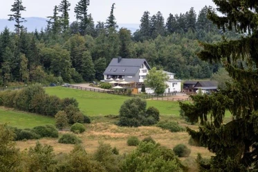
From Vormwald Station, you go up to the Rothaarsteig via hiking path X3. A few steps further, and Ginsburg, the first highlight of the route, is already reached. The ascent is worthwhile because there is a wonderful view over the snowy Siegerland at the top. Those who wish can already take a break here or at the nearby Hotel Ginsberger Heide. Through the Ginsberger Heide, a nature reserve with rare plant and animal species, the route continues towards Giller. Giller, at 653 m, is the highest elevation in this region. If you like, you can climb the Gillerberg Tower and enjoy the special view over the landscape. Those not completely free of vertigo also have a great view at the foot of the tower. Depending on the weather, you can also watch a beautiful sunset here. Continuing along the Rothaarsteig, the Lützel Station is reached after about 1.7 kilometers.
Waypoints


Good to know
Best to visit
Directions
Vormwald Station - Ginsburg - Ginsberger Heide - Giller - Lützel
Tour information
Stop at an Inn
Equipment
The Rothaarsteig leads over numerous natural paths away from agricultural and forestry roads. Therefore, weatherproof clothing and sturdy footwear are a must for every hike. We want you to experience the "Path of the Senses" not only "dry" but also "with good feet."
In our small hiking shop at www.rothaarsteig.de/shop you will also find a selection of Rothaarsteig items for preparing your route or as souvenirs. We also gladly recommend the durable and high-quality outdoor equipment from our longtime partner, the outdoor outfitter Tatonka.
Hiking backpack
With a suitable hiking backpack, your route on the Rothaarsteig becomes twice as fun! Hiking backpacks offer very comfortable wearing properties thanks to a ventilated carrying system, which causes sweat to evaporate immediately. They can be secured with a waist or hip belt and thus fit tightly to your back during every movement. Additionally, they are equipped with practical holders for hiking poles and often offer a compartment with an outlet for a hydration bladder so that your fluid supply is always ensured.
Rainwear
If changeable weather is forecast for your route on the Rothaarsteig, remember to pack a light rain jacket or a rain poncho. They take up almost no space in your backpack and also keep unpleasant wind away. Gaiters are also practical to protect the trouser legs from dirt and moisture. At our partner, the outdoor outfitter Tatonka, you will find high-quality, breathable rain jackets with minimal packing size, light rain capes, and gaiters for the trouser legs to keep them protected from dirt and moisture.
Here you find women's rain jackets from Tatonka
Here you find men's rain jackets from Tatonka
First aid kit
To fully enjoy your hiking tour on the Rothaarsteig, a first aid kit should safely be in your backpack. After all, nothing is more annoying than a blister on your foot or small injuries that cannot be treated cleanly right away. The first aid kits from Tatonka are filled with all important materials for initial care of injuries and also include an "outdoor cheat sheet" with a brief and clear guide for the correct behavior in emergencies in the wild. Here you will find the first aid kits from Tatonka!
Food and drinks
On some stages, especially between Lahnhof and Dillenburg, there are unfortunately no places to stop along the way. Remember to pack food and drinks especially here. Adequate fluid intake is especially important in summer.
Directions & Parking facilities
The train stations in Vormwald and Lützel are accessible via Deutsche Bahn.
You can find current timetable information at www.bahn.de.
Additional information
More information about the Rothaarsteig is available at www.rothaarsteig.de or by phone on the free service hotline at +49 2974 / 499 4163. We will gladly advise you personally on your route planning.
Literature
To prepare for your hike, we will gladly send you our free information package. At www.rothaarsteig.de/prospekte you can easily choose which information you need. A good companion for every route is our brochure "Rothaarsteig Guide" with the hosts along the trail and other useful information.
Author
Katharina Schwake-Drucks
Organization
Touristikverband Siegen-Wittgenstein e.V.
License (master data)

Author´s Tip / Recommendation of the author
- Arrival and departure by train
- View from Ginsburg
- Landscape of the Ginsberger Heide
- For those not afraid of heights: View from the Gillerberg Tower
Safety guidelines
Information about the rescue markers on the Rothaarsteig
Hiking trails usually run away from towns and settlements, and all hikers have surely wondered what would happen if there was an emergency now. How can I be found here? Where am I actually? Can the rescue service reach me?
In an emergency, it must be quick! That is why the Rothaarsteig is continuously equipped with so-called rescue signs. On the green and white plaques attached to the posts of the signposts, there is a number that you must give when making an emergency call. This way, the rescue forces know exactly where you are, and valuable time can be saved.
Notes on winter hiking:
- Consider when planning your routes that hiking in winter with snow is more exhausting and you are therefore moving more slowly. Plan more time accordingly.
- Also remember that it gets dark earlier in winter!
- The Rothaarsteig is not continuously prepared. Due to snowdrifts, it may happen that you sometimes hike through deeper snow.
- If a lot of snow has fallen and the snow lies on the trees, snow breakage can occasionally occur. Be accordingly alert and occasionally look up.
- Various sections of the Rothaarsteig are groomed as cross-country ski tracks under corresponding snow conditions. Please do not step into the groomed track as it will be damaged.
- If necessary, take hiking poles for better stability. Gaiters over the shoes additionally prevent snow from getting into the shoes.
- To warm up in between, we recommend packing a thermos flask with warm tea in the backpack.
Map
The original Rothaarsteig hiking map at a scale of 1:50000 on waterproof paper, with current route guidance and useful markings such as shelters, parking lots, bus stops, and more, can be conveniently ordered free of shipping costs for 11.00 Euros at www.rothaarsteig.de/wanderkarte.
Nearby


