A1 Rudersdorf

4.60 km long
Round trip
Difficulty: easy
Condition: very easy
Great panorama
Regional hiking trail
  • 1:14 h
  • 4.60 km
  • 108 m
  • 108 m
  • 321 m
  • 430 m
  • 109 m
  • Start: On the L722 between Anzhäuser Mühle and the entrance to Rudersdorf
  • Destination: On the L722 between Anzhäuser Mühle and the entrance to Rudersdorf
The 4.6 km long circular hiking trail A1 runs north of the Wilnsdorf district Rudersdorf.

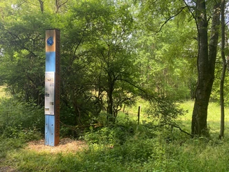
Along the Mühlenbach and the Asberg, the hike invites you to a small excursion. Due to the connection to the Rothaarsteig trail Gernsdorfer Höhentour and the Rudersdorf circular route A3, the route can be flexibly adjusted or extended.

Waypoints

Start
On the L722 between Anzhäuser Mühle and the entrance to Rudersdorf
CC-BY-SA | Gemeinde Wilnsdorf
Aussichtspunkt Asberg
Vantage point/Observation tower
Destination
On the L722 between Anzhäuser Mühle and the entrance to Rudersdorf

Good to know

Best to visit

suitable
Depends on weather

Directions

Our circular route starts at the junction of L722 to K11 towards Netphen-Salchendorf. Along the Mühlenbach we follow the signage until we cross K11. Then it goes on the Rothaarsteig trail towards Asberg. A small detour to the viewpoint opens up a great view of the districts Gernsdorf and Rudersdorf. We continue running parallel to K11 back towards the entrance of Rudersdorf and reach our starting point again after about 4.6 km.

Tour information

  • Loop Road

Equipment

No special equipment is required.

Directions & Parking facilities

By car via L722 or K11
Parking spaces are available north of the Weißbachtal nature reserve, at the junction towards Wilnsdorf.

Accessible by train and bus

Information from ZWS (Local Transport Association Westphalia-South), Tel.: 01806/504030 (0.20 EUR/call from landline, mobile max. 0.60 EUR/min.)

Additional information

www.wilnsdorf.de

Author

Lena Wildfeuer

Organization

Südliches Siegerland

License (master data)

License: Attribution, ShareAlike

Map

Cycle tour and leisure map Siegerland-Wittgenstein with accompanying booklet, 1:50,000, ISBN 3-87073-280-3, 7.95 €

Hiking map Southern Siegerland, 1:25,000, 7.95 €

Nearby

Contact

A1 Rudersdorf
K11
57234 Wilnsdorf