Wilgersdorf circular route

17.49 km long
Round trip
Difficulty: medium
Condition: medium
Great panorama
Regional hiking trail
  • 4:41 h
  • 17.49 km
  • 317 m
  • 317 m
  • 341 m
  • 568 m
  • 227 m
  • Start: Hiking parking lot at Hirschstein
  • Destination: Hiking parking lot at Hirschstein
The approximately 18 km long circular route runs around the Wilnsdorf district of Wilgersdorf.

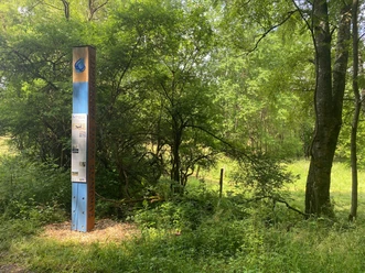
Wilgersdorf is nestled between Kalteiche (579m) in the south, Tiefenrother Höhe (551m) in the east, and Hemmersberg (467m) in the west. Here originates the Weiß, an 18 km long stream that flows into the Sieg in Siegen and forms a narrow, wooded valley. The path literally leads hikers through meadows, fields, and forests and, in addition to a highlight on the Rothaarsteig, the viewing platform "Nose in the Wind," offers many other natural and educational sights.

Waypoints

Start
Hiking parking lot at Hirschstein
Birkenhof mit Hofladen und Hofcafé
CC-BY-SA | Anna Meurer, REACT-EU / Kreis Siegen-Wittgenstein, Achim Meurer
Hofladen Birkenhof
farm shop
© Tobias Vollmer, Birkenhof Apartments
Birkenhof Apartments
Holiday apartment

Good to know

Best to visit

suitable
Depends on weather

Directions

We leave the parking lot at Hirschstein heading towards Kalteiche, which, at 579 m above NHN, is the highest elevation in the municipality of Wilnsdorf. Then we continue towards Hemmersberg and pass the CVJM Youth Education Center and the noteworthy miners' monument. After crossing the K25, we continue to the Weißbachtal nature reserve, which impresses with its unique valley view. After a short time, we reach Birkenhof. In the associated farm shop and café, we can refresh ourselves before continuing towards Ziegenberg. We walk through beautiful landscape towards Gernsbacher Höhe. From there, the path leads us along the long-distance hiking trail Rothaarsteig, characterized by wonderful views and forest paths along this route. At the viewing platform "Nose in the Wind" on Tiefenrother Höhe, we enjoy the breathtaking panoramic view and take a short break. The subsequent educational Hauberg path is also worth a visit. Afterwards, our route follows the historic border to Hesse back to our starting point at Hirschstein.

Tour information

  • Loop Road

  • Stop at an Inn

Equipment

No special equipment required.

Directions & Parking facilities

Coming from Burbach/Haiger via the B54 to Hirschstein

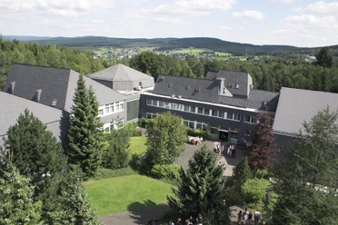
Coming from Wilnsdorf via the K25 to the CVJM Youth Education Center

Free parking is available at various points. The area around the CVJM Youth Education Center or the hiking parking lot at Hirschstein is recommended as a starting point.

Information from ZWS (Westfalen-Süd Public Transport Association), Tel.: 01806/504030 (€0.20/call from landline, mobile max. €0.60/min.)

From Rudersdorf station, walk south on hiking trail A3 to Birkenhof.

Additional information

Municipality of Wilnsdorf

Marktplatz 1

57234 Wilnsdorf

Tel. 02739/802-0, Fax -139

rathaus@wilnsdorf.de

www.wilnsdorf.de

Author

Lena Wildfeuer

Organization

Südliches Siegerland

License (master data)

License: Attribution, ShareAlike

Author´s Tip / Recommendation of the author

The viewing platform "Nose in the Wind" and the Hauberg path on the Rothaarsteig are worthwhile points of interest.

Places to eat and stay along the route: Birkenhof and CVJM Youth Education Center

Map

Bike touring and leisure map Siegerland-Wittgenstein with accompanying booklet, 1:50,000, ISBN 3-87073-280-3, €7.95

Hiking map Southern Siegerland, 1:25,000, €7.95

Nearby

Contact

Wilgersdorf circular route
Birkenhof
57234 Wilnsdorf