Nature experience trails on the Trupbacher Heide


- 4:00 h
- 15.20 km
- 350 m
- 350 m
- 292 m
- 404 m
- 112 m
- Start: Hiking parking lot Trupbach
- Destination: Hiking parking lot Trupbach
The circular trails vary in length between five and nine kilometers. They run over large sections with slight elevation differences.
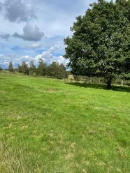
The heath landscape, unusual for the forested Siegerland, is the result of decades of use as a military training area. From 1936 to 1993, first German and then Belgian tanks circled here after the war. At the same time, and still today, environmentally friendly grazing with sheep takes place. This ensures the openness of large areas and shapes the character of the poor meadows and rough grasslands. Thus, a variety of animal and plant species can be found here that are no longer present in the more intensively managed surrounding areas.
More information about the biological special features of Trupbacher Heide
Good to know
Best to visit
Directions
The hiking area Trupbacher Heide offers a variety of paths that open up the area for hikers. The flyer linked under "Literature" for download, which is also posted on the board at the starting point, offers different route variants and also allows shorter circular courses.
The extensively managed open land and the forests offer a variety of quiet places to linger
Tour information
Loop Road
Directions & Parking facilities
From highway 45 (Sauerland line), you can reach the starting point at the hiking parking lot via exit 20/Freudenberg and then towards Siegen. From country road 562, Trupbacher Straße branches off to the left at a traffic light at an intersection towards Trupbach. The small Trupbacher Straße leads up to the hill with the parking lot. Distance: just under 10 kilometers, coordinates 50.901092, 7.985809
Another starting point is on the northern side of the Trupbacher Heide above Freudenberg-Alchen.
Attention: The turn-off from the road leads to a partly rutted forest path to the hiking parking lot at the water tank 150 meters above. Be careful when reentering the poorly visible road. coordinates 50.909036, 7.951916
Literature
Wandergeschichten.de: The online magazine presents the hiking area in Siegen with information and pictures:
Author
Stadtmarketing Siegen GmbH
Organization
Touristikverband Siegen-Wittgenstein e.V.
License (master data)

Author´s Tip / Recommendation of the author
The area is indeed used by many hikers, but those seeking relaxation spread out over the large area. Pure tranquility is guaranteed. It is a good idea to pack a snack and a blanket in your backpack and look for a quiet spot for a picnic. The open meadows especially invite children to play.
Map
Nearby


Download GPX file