Public transport route: On the Rothaarsteig from Dillbrecht to Dillenburg


- 6:15 h
- 21.98 km
- 465 m
- 580 m
- 224 m
- 447 m
- 223 m
- Start: Haiger-Dillbrecht station
- Destination: Dillenburg station
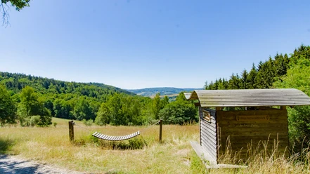
From the starting station Haiger-Dillbrecht, you hike along the yellow-marked Rothaarsteig access trail to the Lucaseiche. The approximately 220-year-old tree is protected as a natural monument and represents a special feature along the route. There, the Rothaarsteig access trail meets the main Rothaarsteig trail, which you now follow past the Steinbach forester's house through the town of Rodenbach. The hilltop east of the town invites you to take a break with its wide view. At a shelter, you can rest and then continue your way through Manderbach to Dillenburg. There, you will find a variety of well-preserved half-timbered houses in the old town. Not far from the old town is the Hofgarten, where the southern starting point of the Rothaarsteig is located.
If the approximately 21 kilometers are too long for you, you can also take the train only up to Rodenbach instead of Dillbrecht and start your hike from there. This shortens your route to about 13.8 kilometers.
Waypoints

Good to know
Best to visit
Directions
Equipment
The Rothaarsteig leads over numerous natural paths away from agricultural and forestry roads. Therefore, weatherproof clothing and sturdy footwear are a must for every hike. We want you not only to experience the "path of the senses" "dry" but also "with good feet".
In our small hiking shop at www.rothaarsteig.de/shop, you will find a selection of Rothaarsteig items to prepare for your route or as souvenirs. We are also happy to recommend the durable and high-quality outdoor equipment of our longtime partner, the outdoor outfitter Tatonka.
Hiking backpack
A suitable hiking backpack makes your tour on the Rothaarsteig twice as fun! Hiking backpacks offer very comfortable carrying properties due to a ventilated carrying system, which ensures that sweat can evaporate immediately. They can be fixed with a waist or hip belt and thus fit firmly to your back during every movement. Furthermore, they are equipped with a practical holder for hiking poles and often come with a compartment with a hose outlet for a hydration bladder, ensuring fluid supply at all times.
Rainwear
If variable weather is forecasted for your tour on the Rothaarsteig, remember to pack a light rain jacket or rain poncho. They take up almost no space in your backpack and also protect against unpleasant wind. Also practical are gaiters that protect the trouser legs from dirt and moisture. At our partner, the outdoor outfitter Tatonka, you will find high-quality, breathable rain jackets with minimal pack size, light rain capes, and gaiters for the trouser legs to keep them protected from dirt and moisture.
Here you can find Tatonka rain jackets for women
Here you can find Tatonka rain jackets for men
First aid kit
To enjoy your hiking tour on the Rothaarsteig without restrictions, a first aid kit belongs safely in your backpack. After all, nothing is more annoying than a blister on the foot or small injuries that you cannot treat right away. Tatonka's first aid kits are filled with all essential materials for initial treatment of injuries and also contain an "outdoor cheat sheet" with concise and clear instructions for proper behavior in emergencies in the wilderness.
Here you can find the first aid kits from Tatonka!
Food and drinks
On some stages, especially between Lahnhof and Dillenburg, unfortunately, there are no opportunities to stop for refreshments along the way. Therefore, remember especially here to pack food and drinks. Sufficient fluids are particularly important in summer.
Directions & Parking facilities
If you arrive by car in Dillenburg, you can park for free and without time limits at the Aquarena (Stadionstraße 10, Dillenburg).
The towns Haiger-Dillbrecht and Dillenburg are both accessible by Deutsche Bahn.
If you want to shorten the distance a bit, you can also start from Rodenbach station. From there, it is about 13.8 kilometers to Dillenburg.
Further information is available at www.bahn.de.
We recommend using public transportation at the start of your route and positioning a car at the endpoint. This way, you don't have to align your hike with the bus or train schedule.
Additional information
Refreshment and accommodation options along the route:
More information about the Rothaarsteig is available at www.rothaarsteig.de or by phone on the free service hotline +49 2974 / 499 4163. We are happy to personally advise you on your route planning.
Literature
To prepare for your hike, we will gladly send you our free information package. At www.rothaarsteig.de/prospekte, you can easily choose which information you need. A good companion for any route is our brochure "Rothaarsteig signposts" with hosts along the trail and other useful info.
Author
Katharina Schwake-Drucks
Organization
Touristikverband Siegen-Wittgenstein e.V.
License (master data)
Author´s Tip / Recommendation of the author
- Lucaseiche
- Old town of Dillenburg
- Hofgarten and Wilhelm Tower Dillenburg
Safety guidelines
Information about the rescue panels on the Rothaarsteig
Most hiking trails run away from towns and settlements, and everyone who hikes has surely wondered what would happen if an emergency occurred. How can I be found here? Where am I anyway? Can the rescue service reach me?
In an emergency, it must be quick! Therefore, the Rothaarsteig is continuously equipped with so-called rescue signs. The green-white plaques attached to the posts of the signposts show a number that you must provide when placing an emergency call. This way, rescuers know exactly where you are, and valuable time can be saved.
Note on increased forest fire risk
Please keep in mind that due to dryness there is currently an increased risk of forest fire! Please observe the following instructions:
- Adhere to the legal smoking ban in the forest - valid in spring, summer and autumn, specifically from March 1 to October 31.
- Observe the ban on open fires in the forest and within 100 meters of the forest.
- Take glass out of the forest - the burning glass effect can cause forest fires.
If it is (too) late:
- Extinguish small starting fires if it is safely possible for you. Check the spot carefully if necessary.
- Report fires by dialing "112".
- Leave the danger area by the shortest way.
The forest thanks you!
Map
The original Rothaarsteig hiking map at a scale of 1:50000 on waterproof paper, with up-to-date route guidance and useful markings such as shelters, parking lots, bus stops, and much more can be ordered conveniently and free of shipping costs for 11.00 euros at www.rothaarsteig.de/wanderkarte.
Nearby


