Rothaarsteig Trail Gernsdorfer Höhentour


- 3:30 h
- 13.44 km
- 187 m
- 187 m
- 350 m
- 531 m
- 181 m
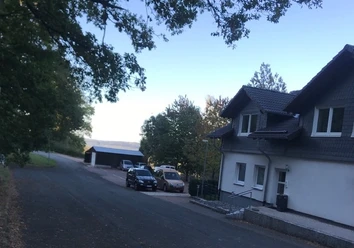
- Start: Gernsdorf town center car park
- Destination: Gernsdorf town center car park
An varied landscape and great views with forests and especially idyllic meadow landscapes await the hiker on the Gernsdorfer Höhentour around the eponymous district of Wilnsdorf. The nature reserve "Gernsdorfer Weidekämpe" is a special feature because of the diversity of the developed cultural landscape with various types of grassland. The term Weidekämpe designates a large cattle pasture introduced from the 19th century on cleared Hauberg areas.
Due to different soil conditions and types of use, various habitat types and plant communities of the open land developed, many of which have great importance for nature conservation. These include grass heath, colorful mountain smooth oat grass meadows, wet pastures, and small sedge swamps. Hedges, solitary trees, swamp areas, and springs offer habitat for many rare animal and plant species and present the visitor with an attractive landscape. Notable species include tens of thousands of orchids. Rare meadow birds in the area are the whinchat and meadow pipit, which, as ground nesters, can only successfully breed where management is extensive and adapted to the breeding season, as here in the protected area.
Another special feature is that the Gernsdorfer trail meets the Hessian trail "Dill-Bergtour" on the Rothaarsteig, so the two Rothaarsteig trails can also be combined into a long hike or planned in two stages.
Certified as "dream routes" by the German Hiking Association, the Rothaarsteig trails are particularly suitable for your day or half-day tour on the Path of the Senses. All Rothaarsteig trails are marked with the white, lying R on a black background. Detailed route descriptions of the trails can be found online at www.rothaarsteig.de/spuren. Our service hotline +49 2974/4994163 is available daily free of charge from 9:00 a.m. to 8:00 p.m.
Waypoints


Good to know
Best to visit
Directions
We start from the hiking car park at the start portal in Gernsdorf. Passing the country inn Drei Eichen, we turn right after a short time and leave the footpath. Uphill it continues to the viewpoint Asberg. From there it first leads us further towards Helgersdorf before we pass the Jakobsweg and immediately leave towards Gernsdorfer Weidekämpe. After crossing the L722, we walk along the nature reserve Gernsdorfer Weidekämpe, which is a special feature due to the great diversity of grassland types. We continue towards Gernsbacher Höhe. After about 6.5 km, we reach the Rothaarsteig. We walk parallel with the Rothaarsteig trail "Dill-Berg-Tour" for about 1 km before leaving the Rothaarsteig again. After another viewpoint, we reach the Jägersborn spring. Shortly afterwards, we reach the Obere Langenbachtal, the second nature reserve on our tour. On a path, we head back towards Gernsdorf. Along the Bichelbach, we reach our starting point again after about 13 km.
Tour information
Loop Road
Stop at an Inn
Equipment
The Rothaarsteig leads over numerous natural paths away from agricultural and forestry roads. Therefore, weatherproof clothing and sturdy footwear are a must for every hike. We want you not only to experience the 'Path of the Senses' "dry" but also "on good footing".
Rainwear
If variable weather is forecast for your tour on the Rothaarsteig, remember to pack a light rain jacket or a rain poncho. They barely take up any space in your backpack and also protect you from unpleasant wind. Gaiters that protect the trouser legs from dirt and moisture are also practical.
First-aid kit
To fully enjoy your hiking tour on the Rothaarsteig, a first-aid kit should definitely be in your backpack. After all, nothing is more annoying than not being able to immediately treat a foot blister or minor injuries cleanly.
Food and drinks
On some stages, especially between Lahnhof and Dillenburg, there unfortunately are no places to stop for refreshments along the way. Keep this in mind, especially here, and pack food and drinks. Adequate drinks are especially important in summer.
Directions & Parking facilities
Coming from Siegen via K11 or via B54 to Niederdielfen and further via L893 and L722 towards Gernsdorf.
Coming from Wilnsdorf via L722 via Rudersdorf to Gernsdorf.
Free parking spaces are available at the start portal in the center of Gernsdorf (corner of Gernsdorfer Straße/ Drei-Eichen-Straße).
Further parking options can be found at short distance from the starting point at the Ehrenmal/Cemetery in Gernsdorf (Drei-Eichen-Straße).
Information on tickets and tariffs as well as timetable information can be found at the following link: www.zws-online.de
Exit stop: Gernsdorf Ort
Nearest station: Rudersdorf (about 3km from the starting point)
We recommend using public transport at the start of your tour and positioning a car at the end point. This way you don't have to depend on bus/train schedules during your hike.
Additional information
Municipality of Wilnsdorf
Marktplatz 1
57234 Wilnsdorf
Tel. 02739/802-0, Fax -139
Further information about the Rothaarsteig is available at www.rothaarsteig.de as well as by phone at the free service hotline +49 2974 / 499 4163. We are happy to advise you on your personal tour planning.
Literature
To prepare for your hike, we will be happy to send you our free information package. At rothaarsteig.de/prospekte you can easily choose which information you need. A good companion for every tour is our Rothaarsteig guide with the hosts along the trail and further useful information.
Author
Lena Wildfeuer
Organization
Südliches Siegerland
License (master data)

Author´s Tip / Recommendation of the author
After the hike, the restaurateurs look forward to your visit. Share your impressions of the hike over freshly prepared dishes and a cool drink. Small snacks are offered by bakeries, butcher shops and the local grocery store.
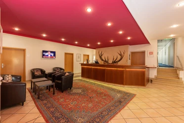
Country Inn Drei Eichen, Wilnsdorf-Gernsdorf, Phone: 02737-9576, www.landgasthof-drei-eichen.de
Hotel Restaurant Gästehaus Wilgersdorf, Wilnsdorf-Wilgersdorf, Phone: 02739/8969-0, Quality Rothaarsteig provider, www.gaestehaus-wilgersdorf.de
Gasthof Ley, Netphen-Irmgarteichen, Phone: 02737/91094, www.gasthof-ley.de
Gasthof Jokebes, Netphen-Irmgarteichen, Phone: 02737/9583, Quality Rothaarsteig provider, www.gasthof-jokebes.de
Please inquire by phone about the opening hours and offers of the businesses. Further information on gastronomy and accommodation businesses in the municipality of Wilnsdorf can also be found online at: www.wilnsdorf.de
Safety guidelines
Note on the route
The Gernsdorf Rothaarsteig trail meets the Hessian Rothaarsteig trail "Dill-Bergtour" on the Rothaarsteig. All Rothaarsteig trails are marked with the white, lying R on a black background. Please pay attention to the additional signposts so you don't miss your turn-off!
Information on the rescue signs on the Rothaarsteig
Most hiking trails run away from towns and settlements, and every hiker has surely wondered what would happen in an emergency. How can I be found here? Where am I exactly? Can rescue services reach me?
In an emergency, speed is crucial! Therefore, the Rothaarsteig is continuously equipped with so-called rescue signs. On the green-white plaques attached to the posts of the signposts, there is a number that you must provide when making your emergency call. This allows the rescue services to know exactly where you are and valuable time can be saved.
Note on increased forest fire risk
Please keep in mind that due to dryness, there is currently an increased forest fire risk! Therefore, please observe the following notes:
- Observe the legal smoking ban in the forest – it applies in spring, summer, and autumn, specifically from March 1st to October 31st.
- Observe the ban on open fires in the forest and within 100 meters of the forest.
- Take glass out of the forest – the magnifying effect of glass can cause forest fires.
If it is (too) late:
- Extinguish small emerging fires if it is safe for you to do so. Check the area carefully if necessary.
- Report fires by calling "112".
- Leave the danger area by the shortest route.
The forest thanks you!
Map
Hiking map Southern Siegerland, 1:25,000, 7.95 €
In our brochure "Rothaarsteig Trails - All circular hiking routes at a glance" you will find map sections, short explanations for all 13 circular hiking routes, including a map of the Breitscheider Cave Tour. In addition, the other 12 Rothaarsteig trails are also depicted here with maps, short explanations, and the most beautiful rest stops along the route. You can conveniently and free of charge order the booklet for home delivery or view it online as a PDF or flip catalog under rothaarsteig.de/prospekte.
We also recommend our Rothaarsteig Trails hiking pass. Anyone who has hiked 8 of the 13 trails receives a hiking certificate as well as a Rothaarsteig pin and takes part in our annual raffle. You can also order the hiking pass easily and free of charge for home delivery or download it directly online at rothaarsteig.de/prospekte.
The original Rothaarsteig hiking map in scale 1:50000 on waterproof paper, with current routing and useful markings such as shelters, parking lots, bus stops, and much more can be ordered free of shipping costs for 11.00 euros at rothaarsteig.de/shop, conveniently delivered to your home.
Nearby


Download GPX file