Public transport route: On the Rothaarsteig from Vormwald to Feudingen


- 5:55 h
- 21.04 km
- 444 m
- 539 m
- 388 m
- 645 m
- 257 m
- Start: Vormwald station
- Destination: Feudingen station
If you arrive by car, we recommend parking it at the beginning in Feudingen and taking the train to the starting point in Vormwald.
The hike starts at Vormwald station. If you are already thirsty here, you will find a nice beer garden at the station building. Via path X3, you reach the Rothaarsteig from the station. Once at the top, the Ginsburg awaits you. The Rothaarsteig was officially opened here on 05.06.2001. For a donation, the tower of the Ginsburg is freely accessible. At the top, you then enjoy a 360-degree view. There is also the possibility to refresh yourself at the Ginsburg. The next tower is not far. Further along the Rothaarsteig, you now reach the Gillerberg tower. The 15-meter-high tower with its open structure is somewhat adventurous and rather for those not afraid of heights. Next, the route leads towards Lützel. After a few kilometers, you descend via a meadow path into the village. After crossing the road, you are soon back in green surroundings, where a footbridge and a welcome cooling await you. In the next kilometers to the Eder spring, a beautifully situated bridge ideal for a photo awaits you. Arriving at the Eder spring, you are simultaneously in a raised bog.
Near the historic Eisenstraße, the path continues to Benfe. The next spring - the Sieg spring - is now very close. A steep climb leads up over the hilltop to Großenbach. The Benfe valley greets you here in summer with blueberries and a splendor of foxgloves. Although the Sieg spring is not directly on the route, the short detour of 600 meters back and forth is worthwhile. A small path leads you to the namesake of Siegerland, which flows into the Rhine after 155 kilometers.
From the junction in Großenbach, follow the Rothaarsteig access path (yellow lying R) towards Feudingen-North. First, you go downhill past a church with a pointed roof and a seating area into the village of Volkholz. A short break is worthwhile here because shortly before the end awaits the steepest climb of the route, at the top of which you are rewarded with a panoramic view. Passing the wildlife enclosure, you now reach Feudingen. For a cozy end to the route, the Hotel im Auerbachtal or the Romantik Landhotel Doerr await you here.
Waypoints


Good to know
Best to visit
Directions
Vormwald station - Ginsburg - Gillerberg tower - Lützel - Eisenstraße - Eder spring - Benfe - Großenbach - Sieg spring - Volkholz - Feudingen station
Tour information
Cultural Interesting
Stop at an Inn
Equipment
The Rothaarsteig leads over numerous natural paths away from agricultural and forestry roads. Therefore, weatherproof clothing and sturdy footwear are a must for every hike. We want you not only to experience the 'path of the senses' dry but also on good footing.
In our small hiking shop at www.rothaarsteig.de/shop you will also find a selection of Rothaarsteig items to prepare for your route or as souvenirs. We are happy to recommend the durable and high-quality outdoor equipment from our longtime partner, the outdoor outfitter Tatonka.
Hiking backpack
With a suitable hiking backpack, your route on the Rothaarsteig is twice as much fun! Hiking backpacks offer very comfortable carrying properties thanks to a ventilated carrying system that allows sweat to evaporate immediately. They can be fixed with a belly or hip belt and thus fit firmly on your back during any movement. They are also equipped with a practical holder for trekking poles and often feature a compartment with a hose outlet for a hydration bladder, ensuring hydration at all times.
Rainwear
If changeable weather is forecast for your route on the Rothaarsteig, remember to pack a light rain jacket or a rain poncho. They take up almost no space in your backpack and also block unpleasant wind. Also practical are gaiters that protect trouser legs from dirt and moisture. With our partner, the outdoor outfitter Tatonka, you will find high-quality, breathable rain jackets with minimal packing size, light rain capes, and gaiters for trouser legs to keep them protected from dirt and moisture.
Here you will find the rain jackets from Tatonka for women.
Here you will find the rain jackets from Tatonka for men.
First aid kit
To enjoy your hike on the Rothaarsteig without restriction, a first aid kit certainly belongs in your backpack. Nothing is more annoying than a blister on the foot or minor injuries that cannot be treated immediately and properly. The first aid kits from Tatonka are filled with all important materials for the initial treatment of injuries and also contain an 'outdoor cheat sheet' with a concise and clear guideline for correct behavior in emergencies in the open nature.
Here you will find the first aid kits from Tatonka!
Food and drinks
On some stages, especially between Lahnhof and Dillenburg, there are unfortunately no dining options along the way. Remember especially here to pack food and drinks. Especially in summer, sufficient fluid intake is important.
Directions & Parking facilities
Both Vormwald and Feudingen have a station and are accessible by Deutsche Bahn. Current connections can be found at www.bahn.de.
If you arrive by car, we recommend parking it in Feudingen, for example at the station, and taking the train to the starting point in Vormwald. This way you can hike relaxed and don't have to rush at the end of the route to catch the train.
Additional information
Dining and overnight accommodation options along the route:
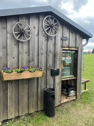
- Zollposten at Vormwald station
- The Ginsburg
- Landgasthof zur Siegquelle in Großenbach
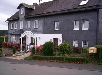
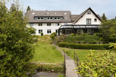
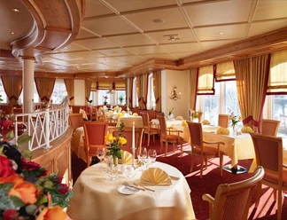
- Hotel im Auerbachtal in Feudingen
- Romantik Landhotel Doerr in Feudingen
Further information about the Rothaarsteig is available at www.rothaarsteig.de or by phone at the free service hotline +49 2974 / 499 4163. We are happy to advise you personally on your route planning.
Literature
To prepare for your hike, we will gladly send you our free info package. At www.rothaarsteig.de/prospekte, you can easily choose which information you need. A good companion for every route is our brochure "Rothaarsteig Guide" with hosts along the trail and other useful information.
Author
Katharina Schwake-Drucks
Organization
Touristikverband Siegen-Wittgenstein e.V.
License (master data)
Author´s Tip / Recommendation of the author
- The Ginsburg with 360-degree views
- The Gillerberg tower
- The Eder spring surrounded by a raised bog
- The Sieg spring
Safety guidelines
Information about the rescue panels on the Rothaarsteig
Hiking trails mostly run away from towns and settlements, and everyone who hikes has probably wondered what would happen if there was an emergency now. How can I be found here? Where am I at all? Can the rescue service reach me?
In an emergency, it must be quick! Therefore, the Rothaarsteig is continuously equipped with so-called rescue signs. On the green-white plaques attached to the posts of the signposts, there is a number that you must give when making an emergency call. This way, the rescuers know exactly where you are, and valuable time can be saved.
Note on increased forest fire risk
Please note that due to dryness, there is currently an increased forest fire risk! Therefore, please observe the following instructions:
- Observe the legal smoking ban in the forest - effective in spring, summer, and autumn, precisely from March 1 to October 31.
- Observe the ban on open fires in the forest and within 100 meters of the forest.
- Take glass out of the forest - the burning glass effect can cause forest fires.
If it is (too) late:
- Extinguish small starting fires if it is safe for you to do so. Check the spot carefully if necessary.
- Report fires by dialing "112".
- Leave the danger area by the shortest route.
The forest thanks you!
Wisent and wild animals on the Rothaarsteig - behavior tips
Many species of wild animals live in the forests on the Rothaarsteig. Encounters with red deer, wild boar, mouflon, and for some time now also wisents are possible. The latter may meet you on the Rothaarsteig between Albrechtsplatz and Dreiherrenstein.
The risks posed by wisents for hikers are low and can be reduced to an absolute minimum by appropriately adapted and respectful behavior.
- Pass calmly and inconspicuously at a distance from the animals, do not startle them, and do not look them directly in the eyes.
- If the animals approach, remain calm, do not turn your back to them, and leave the area without haste but always with sight of the animal.
- If the animals come closer than a distance that makes you uncomfortable, shout loudly, whistle, or make yourself audible in another way. Watch for threatening gestures!
- If boars "clack their teeth" or wisents lower their heads, they expect you to withdraw. Back away!
- If you have a dog with you, keep it under control on a leash. If an animal attacks your dog, release it! The dog is faster and more agile than you and will definitely find you again!
Map
The original Rothaarsteig hiking map at a scale of 1:50000 on waterproof paper, with current trail guidance and useful markings such as shelters, parking lots, bus stops, and more, can be conveniently ordered free of shipping costs to your home for 11.00 euros at www.rothaarsteig.de/wanderkarte.
Nearby


")

