Quellenweg Osthelden


- 1:54 h
- 7.98 km
- 177 m
- 176 m
- 304 m
- 392 m
- 88 m
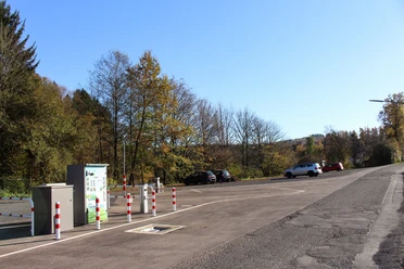
- Start: Parking lot at Robertsweiher on L 714 between Junkernhees and Osthelden, entrance Alter Weg
- Destination: Circular path ends at the starting point
The circular hiking trail begins at the parking lot by Robertsweiher and leads along the Berghäuser Weiher into the Berghäuser Tal. On an asphalt path, it passes two huts up to a junction that leads to the golf course. There, it goes left over the Berghäuser Bach and along its bank to its first spring. Following further side valleys and changing tree species, it then goes downhill to a fork in the path. There, the path leads left uphill to the remains of the former natural monument “Guggugsdänn” (Cuckoo fir), a gnarled spruce that fell victim to storm Friederike in 2019. Here and in the next hollow, the main tributaries of the Berghäuser Bach originate.
The path leads through forest areas destroyed by the Kyrill hurricane in 2007. After crossing the country road, you reach the spring of the Ostheldener Bach. Along its course, the path goes downhill and left before the country road. Behind the next hill lies the spring area of the Frenschenbach, where the forest festival area with shelter invites you to rest. Then comes the Rohbach, whose source is about 150 m above. The path follows the stream downhill to the country road and back to the starting point.
More information at: https://quellenweg.osthelden.eu

Waypoints

Good to know
Best to visit
Tour information
Cultural Interesting
Loop Road
Directions & Parking facilities
Start/finish is located on the R50 route (Olpe − Wenden − Osthelden − Kreuztal), which runs hourly on weekdays. Stop: Alter Weg
Kreuztal station is located on the Ruhr-Sieg railway line.
Additional information
Kreuztal theme trails
- Hauberg trail in the Historic Hauberg Fellinghausen
- Nature experience trail Grubengelände Littfeld
- Kindelsberg trail
- ROTHAARSTEIG access path
- Buschhüttener Eisenhammerweg
- Reckhammer Auenweg in Littfeld
- Quellenweg Osthelden
Six SGV departments maintain the approximately 275 km long hiking trail network in Kreuztal: the departments Littfeld, Krombach, Fellinghausen, Ferndorf-Kreuztal, Kredenbach and Buschhütten. Guided hikes regularly take place, during which guests are warmly welcome.
Contact
City of Kreuztal Tourism
Siegener Str. 3 / 57223 Kreuztal
Tel.: 02732/5 14 35 / Fax: 27 91 02 70
Email: stadt_kreuztal@kreuztal.de and m_haeusig@kreuztal.de www.kreuztal.de
Author
Wolfgang Hoffmann
Organization
Touristikverband Siegen-Wittgenstein e.V.
Author´s Tip / Recommendation of the author
Robertsweiher („Kahnwejjer") / Berghäuser Weiher
The ponds between Osthelden and Junkernhees were created by the nobles "von der Hees" for fish farming to enrich the menu of the kitchen in Junkernhees Castle. Many children used to learn swimming here, ice skating in winter, or playing ice hockey. Boat trips were also once very popular. Even today, anglers pursue their hobby here and walkers enjoy the diverse fauna and flora.
Forest festival area in the Frenschenbach
Since 1960, the Osthelden Singing Club's forest festival has been held in this location at Pentecost. The fire brigade’s firefighting group has held summer festivals here several times over recent years, and the Evangelical church community has organized open-air services together with the Evangelical Fellowship. More information: www.buergerverein-osthelden.de
„Kölsches Heck"
The country road to Wenden passes over an old state border at the height. There, from 1446 to 1448, the Count of Nassau-Siegen had a 55 km long hedge built to protect his territory from raids and smuggling from the Sauerland, which belonged to the Archdiocese of Cologne. To this day, a strongly pronounced cultural-geographical boundary exists between Siegerland and Sauerland. Remains of the “Kölsches Heck” and old hollow paths are still visible in some places, for example at the "Ostheldener Schlag," an old border crossing. More information: www.eisenstraße-suedwestfalen.de
Safety guidelines
Map
Hiking map Kreuztal, available in regional bookstores and from the city of Kreuztal, € 5.00
Cycling and leisure map Siegerland-Wittgenstein with accompanying booklet, 1:50,000, ISBN 3-87073-280-3, € 7.95
Nearby


Download GPX file