Rothaarsteig from the Lahn source to Wilgersdorf


- 4:45 h
- 18.85 km
- 217 m
- 439 m
- 397 m
- 673 m
- 276 m
- Start: Lahn source near Netphen
- Destination: Wilnsdorf-Wilgersdorf
The Rothaarsteig stage begins at the source of the Lahn and leads directly to the Ilse source, which is known not for its size but for its mysterious healing powers. The Ilse was considered a holy source especially in the Middle Ages and was a pilgrimage site for many years. Today you have the chance to enjoy the refreshing spring water on site.
From the Ilse source, the Rothaarsteig continues westward. Over the Jagdberg (674m), the path reaches the rest area "Kaffeebuche," from which you can enjoy a beautiful view over the landscape. In the valley below lies the village of Hainchen with the only elevated water castle in Westphalia. However, the Rothaarsteig remains on the ridge.
The next destination is again a source: The Dill is a 55-kilometer-long tributary of the Lahn and forms the natural border between the Hessian Westerwald and the Lahn-Dill hill country. After Haincher and Gernsbacher (523 m) follows ultimately the Tiefenrother height (551m). Here you can enjoy spectacular views and breathtaking sunsets from the viewing platform "Nose in the Wind."
After a small quarry, you reach the (newly planted) Hubertus beech with a small rest area. Here you leave the Rothaarsteig and go down the access path to Wilgersdorf.

Waypoints


Good to know
Best to visit
Directions
Lahn source - Ilse source - Jagdberg - Haincher height - Dill source - Gernsbacher height - Tiefenrother height - Hauberg path - Kalteiche
Tour information
Familiy-Friendly
Labelling
Premium Trail "Wanderbares Deutschland"
Stop at an Inn
Tour with Dog
Equipment
The Rothaarsteig runs over numerous natural paths away from agricultural and forestry roads. Therefore, weatherproof clothing and sturdy footwear are a must for every hike. We want you not only to experience the "path of senses" "dry" but also "on good feet".
In our small hiking shop at www.rothaarsteig.de/shop you will also find a selection of Rothaarsteig articles to prepare for your route or as souvenirs. We also gladly recommend the durable and high-quality outdoor equipment from our longtime partner, the outdoor outfitter Tatonka.
Hiking backpack
With a suitable hiking backpack, your route on the Rothaarsteig is twice as much fun! Hiking backpacks offer very comfortable carrying properties through a ventilated carrying system, which ensures that sweat can evaporate immediately. They can be fixed with a belly or hip belt and thus sit firmly on the back during every movement. In addition, they are equipped with a practical holder for hiking poles and often also have a compartment with a hose outlet for a hydration bladder, ensuring fluid supply at any time.
First aid kit
To enjoy your hike on the Rothaarsteig unrestrictedly, a first aid kit surely belongs in your backpack for safety reasons. After all, nothing is more annoying than a blister on the foot or small injuries that can't be treated immediately and cleanly. The first aid kits from Tatonka are filled with all important materials for first treatment of injuries and also contain an "outdoor cheat sheet" with a concise and clear guideline for the correct behavior in emergencies in the open nature. Here you can find the first aid kits from Tatonka!
Provision and drinks
On some stages, especially between Lahnhof and Dillenburg, there are unfortunately no places to eat along the way. Therefore, remember to pack provision and drinks here in particular. Especially in summer, sufficient fluid intake is important.
Directions & Parking facilities
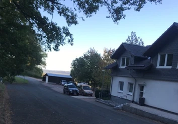
Unfortunately, the Lahn source is not served by public transport. Here you have to rely on a taxi that takes you to the nearest station to Rudersdorf. From there, you can reach the train lines towards Gießen or Siegen. You can order a taxi via the chargeable hotline 22456 (mobile phone number for taxi orders throughout Germany).
In Wilgersdorf there are various bus lines. The nearest train station is also Rudersdorf.
Further information can be found at www.bahn.de.
If you arrive by car, we recommend using public transport at the start of your route and positioning your car at the end point. This way, you don't have to adhere to the bus/train schedules during the hike.
Literature
Further information about the Rothaarsteig is available at www.rothaarsteig.de or by phone at the free service hotline +49 2974 / 499 4163. We are happy to advise you personally on your route planning.
To prepare for your hike, we are happy to send you our free information package. At www.rothaarsteig.de/prospekte you can easily choose which information you need. A good companion for every route is our brochure "Rothaarsteig Guide" with hosts along the trail and other useful info.
The Rothaarsteig recommends:
- Hikeline hiking guide: Long-distance hiking trail Rothaarsteig - From Brilon in the Sauerland over the ridge of the Rothaar mountains to Dillenburg
- Conrad Stein Verlag: Hiking guide Rothaarsteig – Long-distance trail. Rothaarsteig from Brilon to Dillenburg by Amrei Risse
- Rother Bergverlag: Rother hiking guide Rothaarsteig. With Sauerland Höhenflug and Sauerland forest route by Matthias Schopp
Author
Rothaarsteigverein e. V.
Organization
Touristikverband Siegen-Wittgenstein e.V.
License (master data)
Author´s Tip / Recommendation of the author
- Lahn source
- Kaffeebuche and Hauberg
- Ilse source
- Haincher height
- Dill source
- Viewing platform "Nose in the Wind"
Guest establishments:
Safety guidelines
Information on the rescue panels on the Rothaarsteig
Hiking trails mostly run away from towns and settlements, and everyone who hikes has surely at some point thought about what would happen if there was an emergency. How can I be found here? Where am I anyway? Can the rescue service reach me?
In an emergency, speed is crucial! Therefore, the Rothaarsteig is continuously equipped with so-called rescue signs. On the green-white plaques, which are attached to the posts of the signposts, there is a number you must provide when placing an emergency call. This allows rescue teams to know exactly where you are, saving valuable time.
Notice on increased forest fire risk
Please consider that due to dryness there is currently an increased forest fire risk! Please observe the following instructions:
- Adhere to the legal smoking ban in the forest - it applies in spring, summer, and autumn, specifically: from March 1 to October 31.
- Observe the ban on open fires in the forest and within 100 meters of the forest.
- Take glass out of the forest - the burning glass effect can cause forest fires.
If it is (too) late:
- Extinguish small fires if it is safe for you. Check the spot carefully if necessary.
- Report fires via "112".
- Leave the danger zone by the shortest way.
The forest thanks you!
Map
Rothaarsteig hiking map at a scale of 1:50,000
- Divided into two sheets (north sheet / south sheet)
- 10th edition - Current route guidance
- With marked shelters, viewpoints, bus stops, parking lots, and more.
- Free shipping in the Rothaarsteig hiking shop
Nearby


