Rothaarsteig from Giller to Haincher Höhe


- 6:55 h
- 26.76 km
- 389 m
- 443 m
- 522 m
- 673 m
- 151 m
- Start: Lützel train station
- Destination: Hiking parking lot Haincher Höhe
On this stage, the Rothaarsteig leads from the roof of Siegerland into the source area of three major rivers: Lahn, Sieg and Eder.
On this route, the Rothaarsteig roughly follows the course of the historic Iron Road over the Rothaar Ridge. The Iron Road was part of the medieval trade route from Cologne to Leipzig and is named because ironware trade was conducted here until the High Middle Ages.
First, the route follows the valley of the young Eder upstream from Lützel train station through the Eicherwald nature reserve. Here the Eder still flows undisturbed by humans. After passing the center of the Siegen-Wittgenstein district, you encounter the raised bog at the Eder spring. From the Eder spring, the Rothaarsteig now leads over the Coal Road to Benfe and further to the Sieg spring. After its redesign in 2014, the spring has become a natural spring area again. The name giver of Siegerland flows into the Rhine after 155 kilometers. If you feel like a small detour, a visit to Waldland Hohenroth, a former forestry region where today an information center for forest, forestry, nature conservation and forest encounters is set up, is worthwhile.
After another three kilometers, you reach the Lahn spring. Like the Sieg, the Lahn flows to the Rhine but only after 246 kilometers. The path leads directly to the Ilse spring, which is famous not for its size but for its mysterious healing powers. The Ilse was regarded especially in the Middle Ages as a holy spring and was a pilgrimage site for many years. Today, you have the possibility to enjoy the refreshing spring water on site.
From the Ilse spring, the Rothaarsteig heads back west. Over the Jagdberg (674 m), the trail reaches the resting place "Kaffeebuche," from which you can enjoy a beautiful view. At the destination, you see the village of Hainchen lying in the valley below with the only high-water castle in Westphalia.
Waypoints


Good to know
Best to visit
Directions
Tour information
Familiy-Friendly
Labelling
Nature Highlight
Possibility of Accommodation
Premium Trail "Wanderbares Deutschland"
Stop at an Inn
Tour with Dog
Equipment
The Rothaarsteig runs over many natural paths away from agricultural and forestry roads. Therefore, weatherproof clothing and sturdy footwear are a must for every hike. We want you to experience the "Path of the Senses" not only "dry" but also "on good feet." In our small hiking shop at www.rothaarsteig.de/shop, you will also find a selection of Rothaarsteig articles to prepare for your route or as souvenirs. We are also happy to recommend the durable and high-quality outdoor equipment from our long-standing partner, the outdoor outfitter Tatonka.
Hiking backpack
A suitable hiking backpack doubles your fun on the Rothaarsteig! Hiking backpacks provide very comfortable carrying properties through a ventilated carrying system, as this ensures that sweat evaporates immediately. They can be fixed with a belly or hip belt and thus fit firmly on the back with every movement. They are also equipped with a practical holder for hiking poles and often have a compartment with a hose outlet for a drinking bladder, ensuring hydration at all times. Here you will find hiking backpacks from the outdoor outfitter Tatonka in different sizes for day hikes and multi-day routes with various ventilated back systems.
First aid kit
To fully enjoy your hiking tour on the Rothaarsteig, a first aid kit should definitely be in your backpack. After all, nothing is more annoying than a blister on your foot or small injuries that cannot be immediately and properly cared for. The first aid kits from Tatonka are filled with all the essential materials for initial treatment of injuries and also contain an "outdoor cheat sheet" with a brief and clear guideline for proper behavior in emergencies in the wild. Here you will find the first aid kits from Tatonka!
Food and drinks
On some stages, especially between Lahnhof and Dillenburg, there are unfortunately no catering options along the way. Remember to pack food and drinks especially here. Particularly in summer, sufficient fluids are important. The stainless steel bottles, stainless steel insulated jugs and stainless steel lunch boxes from Tatonka are not only practical but also unbreakable and durable.
Directions & Parking facilities
Free hiking parking lots are available both in Lützel and in Hainchen.
Lützel has a train station and can be reached by train. Unfortunately, Haincher Höhe is not served by public transport. Further information can be found at www.bahn.de.
Additional information
Further information about the Rothaarsteig is available at www.rothaarsteig.de or by phone at the free service hotline +49 2974 / 499 4163. We are happy to advise you personally on your route planning.
Literature
To prepare for your hike, we are happy to send you our free information package. On www.rothaarsteig.de/prospekte, you can easily select the information you need. A good companion for every route is our brochure "Rothaarsteig Guide" with the hosts along the trail and other useful info.
Contact person
Rothaarsteigverein e. V.
Author
Harald Knoche
Organization
License (master data)
Author´s Tip / Recommendation of the author
- Iron Road
- Hohenroth Forester's House
- Eder spring
- Sieg spring
- Lahn spring
- Kaffeebuche and Hauberg
- Ilse spring
- Haincher Höhe
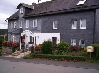
Guest establishments:
Safety guidelines
Information about the rescue panels on the Rothaarsteig
Hiking trails mostly run away from towns and settlements, and everyone who hikes has surely wondered what would happen in an emergency. How can I be found here? Where am I actually? Can the rescue service reach me? In an emergency, time is crucial! Therefore, the Rothaarsteig is continuously equipped with so-called rescue signs. On the green-white plaques attached to the posts of the signposts, there is a number you must provide when making an emergency call. This way, the rescue teams know exactly where you are, and valuable time can be saved.
Note on increased forest fire risk
Please consider that due to the dryness there is currently an increased forest fire risk! Therefore, please observe the following instructions:
- Observe the legal smoking ban in the forest - applicable in spring, summer and autumn, specifically from March 1 to October 31.
- Observe the ban on open fires in the forest and within 100 meters of the forest.
- Take glass out of the forest - the burning glass effect can trigger forest fires.
If it is (too) late:
- Extinguish small starting fires if it is safe for you to do so. Check the spot carefully if necessary.
- Report fires via "112."
- Leave the danger area by the shortest route.
The forest thanks you!
Map
The original Rothaarsteig hiking map at a scale of 1:50000 on waterproof paper, with current route marking and useful features such as shelters, parking lots, bus stops and much more, you can conveniently order to your home for 11.00 euros with free shipping at www.rothaarsteig.de/wanderkarte.
Nearby


