A1 Flammersbach

- 0:43 h
- 2.53 km
- 79 m
- 79 m
- 327 m
- 406 m
- 79 m
- Start: Hiking parking lot at the sports ground
- Destination: Hiking parking lot at the sports ground
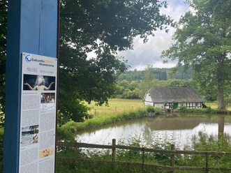
A small but beautiful hike that is connected with other circular routes and thus can be flexibly designed on the way.
Good to know
Best to visit
suitable
Depends on weather
Directions
We leave the parking lot heading north and shortly afterwards turn right to run parallel with the A2 towards Hohe Roth. After about 1 km we leave the A2 and turn right towards Flammersbach. At the edge of the built-up area, we meet the circular routes A2 and A3 as well as the Way of St. James, which lead us back to our starting point at the sports ground.
Tour information
Loop Road
Equipment
No special equipment is required.
Directions & Parking facilities
By car coming from Anzhausen or Niederdielfen, drive to the edge of town. Access also possible via the K11 from Feuersbach or Siegen.
Parking is available opposite the Flammersbach sports ground.
Information at ZWS (Zweckverband Personennahverkehr Westfalen-Süd), Tel.: 01806/504030 (€0.20/call from landline, mobile max. €0.60/min)
Additional information
Municipality of Wilnsdorf
Marktplatz 1
57234 Wilnsdorf
Tel. 02739/802-0, Fax -139
Author
Lena Wildfeuer
Organization
Südliches Siegerland
License (master data)

Map
Cycle touring and leisure map Siegerland-Wittgenstein with accompanying booklet, 1:50,000, ISBN 3-87073-280-3, €7.95
Hiking map Southern Siegerland, 1:25,000, €7.95
Nearby


Download GPX file