Circular route Oberdielfen


- 2:08 h
- 7.54 km
- 182 m
- 182 m
- 308 m
- 424 m
- 116 m
- Start: Hiking car park at Marienweg
- Destination: Hiking car park at Marienweg
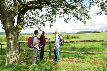
The hiking trail offers beautiful views and wonderful woodland paths.
Waypoints
Start

Destination
Good to know
Best to visit
suitable
Depends on weather
Directions
We leave the hiking car park at Marienweg heading towards Astenberg. Then we continue on forest paths parallel to the B54 towards Wilnsdorf and then turn left towards Oberdielfen. Behind the hiking car park, we cross the L723 towards Oberdielfer sports ground. From there, we continue to the memorial. Further through the village, we cross the L723 again and walk uphill to Bösenberg. After a short time, we reach our starting point again.
Tour information
Loop Road
Stop at an Inn
Equipment
No special equipment is required.
Directions & Parking facilities
Getting there
From Siegen and Wilnsdorf via the B54
Parking
Free parking spaces are available at the starting point.
Public transportation
Information from ZWS (Zweckverband Personennahverkehr Westfalen-Süd), Tel.: 01806/504030 (€0.20/call from landline, mobile max. €0.60/min)
Additional information
Municipality of Wilnsdorf
Market Square 1
57234 Wilnsdorf
Tel. 02739/802-0, Fax -139
Author
Lena Wildfeuer
Organization
Südliches Siegerland
Author´s Tip / Recommendation of the author
Place to eat and stay: Landhaus Wildfein
Safety guidelines
The partly steep sections require a certain level of physical fitness.
Map
Bike touring and leisure map Siegerland-Wittgenstein with accompanying booklet, 1:50,000, ISBN 3-87073-280-3, €7.95
Hiking map Southern Siegerland, 1:25,000, €7.95
Nearby


Download GPX file