A3 Flammersbach


- 1:53 h
- 6.53 km
- 185 m
- 185 m
- 324 m
- 458 m
- 134 m
- Start: Hiking parking lot at the sports ground
- Destination: Hiking parking lot at the sports ground
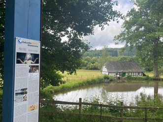
The route impresses with varied landscapes. By linking with other circular hiking routes, the hiking route can also be flexibly designed on the way. Shortcuts are also possible.
Waypoints
Good to know
Best to visit
Directions
Tour information
Loop Road
Equipment
Directions & Parking facilities
Coming from Siegen towards Feuersbach via the K11
From Niederdielfen and Anzhausen via the L893 to the end of Flammersbach village
Additional information
Municipality of Wilnsdorf
Market Square 1
57234 Wilnsdorf
Tel. 02739/802-0, Fax -139
Author
Lena Wildfeuer
Organization
Südliches Siegerland
License (master data)

Author´s Tip / Recommendation of the author
Map
Bicycle hiking and leisure map Siegerland-Wittgenstein with booklet, 1:50,000, ISBN 3-87073-280-3, €7.95
Hiking map Southern Siegerland, 1:25,000, €7.95
Nearby


Download GPX file