Water features - Nature meets technology


- 1:30 h
- 4.60 km
- 62 m
- 62 m
- 284 m
- 328 m
- 44 m
- Start: Hiking parking lot Eicher Weiher
- Destination: Hiking parking lot Eicher Weiher
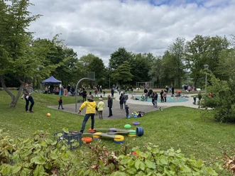
On this eventful hiking route, young and old learn about the importance of water and the Freudenberg ponds for the region's industry throughout history.
8 stations with information boards provide the most important information along the way.


Waypoints


Good to know
Best to visit
Directions
The signage starts with a main sign “P Stadterleben” at the Eicher Weiher parking lot. Path markings along the route assist with further orientation. The “Water features” signs explain the activity and experience points as well as the historical peculiarities of the place. In the Gambach landscape area, they represent the only installation besides the benches.
Tour information
Cultural Interesting
Loop Road
Suitable for Pushchair
Equipment
Sturdy footwear and weather-appropriate clothing are recommended.
Directions & Parking facilities
Additional information
The starting point for visiting the water features is the parking lots at Eicher Weiher and Gambachsweiher.
Author
Pauline Coroly
Organization
Stadt Freudenberg
License (master data)

Author´s Tip / Recommendation of the author
Below the dam, a spot with a valley view and a water experience point has been created. There you have the opportunity to actively experience the water.
Safety guidelines
To cross the Gambach, the path leads over a small bridge.
Nearby


Download GPX file