Access route to the Rothaarsteig from Erndtebrück

- 2:00 h
- 7.66 km
- 182 m
- 128 m
- 476 m
- 635 m
- 159 m
- Start: Center of Erndtebrück
- Destination: Rothaarsteig
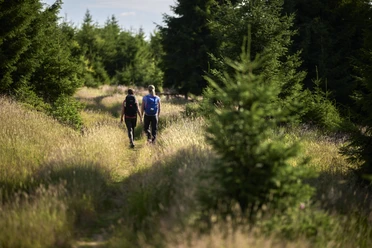
We start the hike in the center of Erndtebrück, passing the Protestant church and a playground, then turn onto the section of the Ederhöhenweg. Here, the trail goes over meadows and through forested areas past the elevations Gickelsberg, Seebach, and Ahornsberg, offering splendid views of the nature reserve and the Eder valley. Later, the route follows the meandering river area of the Eder until we reach the Rothaarsteig.
Waypoints


Good to know
Best to visit
Directions
Starting near the station in the center of Erndtebrück, we begin our hike. We cross Talstraße, walk along Bergstraße past the church, and soon turn right onto the section of the Ederhöhenweg. We follow this below the Gickelsberg, pass the hiking parking lot at Steinseifen, and hike over the 638m high Seebach and past Ahornsberg down to the Eder. Now we follow the river for a stretch until we meet the Rothaarsteig.
Tour information
Stop at an Inn
Equipment
- Day hiking backpack (approx. 20 liters) with rain cover
- sturdy and comfortable footwear
- weather-appropriate and durable clothing in layers
- possibly telescopic poles
- sun and rain protection
- provisions and drinking water
- first aid kit
- pocket knife
- mobile phone
- possibly headlamp
- map material
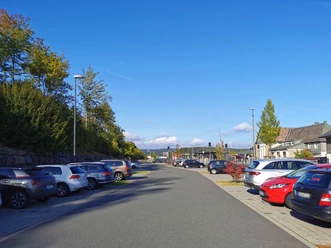
Directions & Parking facilities
Take the A45 exit Siegen, then the B62 to Erndtebrück.
Park & Ride station Erndtebrück
You can get to the center of Erndtebrück by bus and train.
Author
Nathalie Treude
Organization
Touristikverband Siegen-Wittgenstein e.V.
License (master data)

Author´s Tip / Recommendation of the author
Take some time before the hike to stroll through the beautiful rose garden in Erndtebrück.
Nearby