Wittgenstein Panorama route


- 38:45 h
- 144.44 km
- 3,116 m
- 3,102 m
- 320 m
- 768 m
- 448 m
- Start: Wilhelmsplatz in Bad Laasphe
- Destination: This is also where the route ends
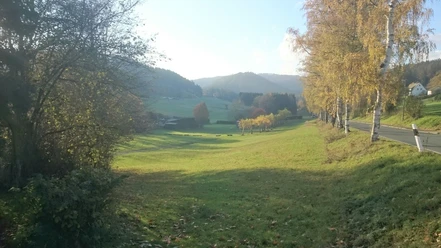
The Panorama route runs 90 miles over the heights of the Wittgenstein mountains. On this route, you get to know the land and people in the southernmost corner of Westphalia very well.
It follows the old district boundary, which included Bad Berleburg, Bad Laasphe, and Erndtebrück until 1974. Hike over mountain ridges and through beautiful meadow valleys. Characteristic for this area are the endless forests, lively streams, and picturesque individual farms.
Due to its elevation profile, the path is quite demanding but mostly runs on well-passable forest trails, so less experienced hikers can also make good progress.
The Wittgenstein Panorama route is consistently marked as an independent long-distance path with a white "W" on a black background.

Waypoints


Good to know
Best to visit
Directions
The big route can be divided into eight day stages.
From Bad Laasphe to Großenbach, approx. 16 miles and 2,149 feet elevation gain,
from Großenbach to Erndtebrück, approx. 10 miles and 2,585 feet elevation gain,
from Erndtebrück to Wingeshausen, approx. 14 miles and 4,550 feet elevation gain,
from Wingeshausen to Bad Berleburg, approx. 6 miles and 1,962 feet elevation gain,
from Bad Berleburg to Girkhausen, approx. 12 miles and 1,516 feet elevation gain,
from Girkhausen to Hatzfeld, approx. 18 miles and 4,226 feet elevation gain,
from Hatzfeld to Richstein, approx. 6 miles and 1,873 feet elevation gain, and
from Richstein to Bad Laasphe, approx. 6 miles and 1,217 feet elevation gain.
Tour information
Cultural Interesting
Loop Road
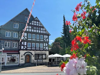
Stop at an Inn
Equipment
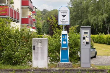
Directions & Parking facilities
Bad Laasphe is accessible from Erndtebrück and Biedenkopf via the B62.
From Bad Berleburg, drive via the B480 to Raumland-Markhausen. There, please turn left onto the L553 towards Dotzlar. In Dotzlar town center, turn onto the L718 to Bad Laasphe.
Organization
BLB-Tourismus GmbH
License (master data)

Author´s Tip / Recommendation of the author
Feel free to make a detour to the Wisent Wilderness or visit Berleburg Castle. A detour to the Drehkoite in Girkhausen is definitely worth it. In Beddelhausen, you'll pass the Kiesel-Schiefer quarry and over the round arch bridge.
Map
Nearby


Download GPX file