F6 Feudingen-Rüppershausen-Oberndorf-Rückershausen-Feudingen


- 3:07 h
- 14.05 km
- 303 m
- 258 m
- 388 m
- 552 m
- 164 m
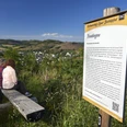
- Start: Starting point is the hiking signboard at the Volksbank in Sieg-Lahn-Straße
- Destination: End point is the hiking signboard at the Volksbank in Sieg-Lahn-Straße
The Feudingen circular hiking route F6 takes us through some of the villages of the "Feudinger Höfe"; Rüppershausen, Oberndorf, Rückershausen, and Weide.
The route starts at the hiking signboard by the Volksbank in Feudingen.
We walk a short distance to the left towards Feudingen train station, turn left and follow the F6 marker.
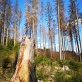
After a short climb past the old slate quarry, we hike following the F6 signs towards the nature reserve "Hermannsteg". Above the path, there is a view of the villages Steinbach, Rüppershausen, Oberndorf, and Rückershausen.
The path passes through the village of Rüppershausen and leads us towards the model airfield above Oberndorf. It’s worth making a short stop there to enjoy the panoramic view of the surrounding villages. Then it continues to the Rückershausen ski area with its unique winter sports facility in the Siegen-Wittgenstein district, consisting of three jumps, a natural ski jump, a matt jump, and a small jumping facility. At the hiking car park, seats in front of the ski hut invite you to rest and catch a view of the three jumping facilities.
The path continues through the village of Weide to the industrial area "In den Espen". From there, the path leads us a short way uphill. Passing the Tannenwald Stadium, we then pass the adjacent school center of Feudingen. It then goes past the memorial with a view of Feudingen and the Protestant Martinskirche from the mid-13th century, which is a listed building, back to the starting point at the Volksbank Feudingen.
Good to know
Best to visit
Directions
The Feudingen circular hiking route F6 takes us through some of the villages of the "Feudinger Höfe"; Rüppershausen, Oberndorf, Rückershausen, and Weide.
The route starts at the hiking signboard by the Volksbank in Feudingen.
We walk a short distance to the left towards Feudingen train station, turn left and follow the F6 marker.
After a short climb past the old slate quarry, we hike following the F6 signs towards the nature reserve "Hermannsteg". Above the path, there is a view of the villages Steinbach, Rüppershausen, Oberndorf, and Rückershausen.
The path passes through the village of Rüppershausen and leads us towards the model airfield above Oberndorf. It’s worth making a short stop there to enjoy the panoramic view of the surrounding villages. Then it continues to the Rückershausen ski area with its unique winter sports facility in the Siegen-Wittgenstein district. At the hiking car park, seats in front of the ski hut invite you to rest and catch a view of the Lahntalschanze, the mattenschanze, and a small jumping facility.
The path continues through the village of Weide to the industrial area "In den Espen" and up to the Feudingen school center. It then goes past the memorial with a view of Feudingen and the Protestant Martinskirche from the mid-13th century, which is a listed building, back to the starting point at the Volksbank Feudingen.
Tour information
Cultural Interesting
Loop Road
Stop at an Inn
Equipment
Sturdy and well-broken-in footwear as well as functional, weatherproof, and durable clothing is recommended, along with a backpack equipped with a small snack and a filled water bottle, including a rain cover. A camera should, of course, not be missing either.
Directions & Parking facilities
Travel to Feudingen is possible by train to Feudingen station and then about 150 meters on foot to the left to the hiking signboard by the Volksbank. By bus, you can travel directly to the hiking signboard at the stop "Feudingen Ortsmitte".
More information about connections can be found at:
Additional information
This path is maintained and marked by SGV Oberes Lahntal Feudingen e.V.. On the club’s homepage, you can find various options for accommodation and dining.
Author
Hans-Joachim Schmidt
Organization
Touristikverband Siegen-Wittgenstein e.V.
License (master data)

Author´s Tip / Recommendation of the author
A visit to the old slate quarry on the Trauberg is recommended.
Safety guidelines
Please stay on the marked path. The path is marked with the F6 sign.
Nearby


