F7 local hiking trail Feudingen "On the heights around the Lahntal jump" Length of the hiking trail F/ 10 km


- 2:40 h
- 10.05 km
- 214 m
- 216 m
- 444 m
- 660 m
- 216 m
- Start: At the hiking car park of the ski cabin in Rückershausen at the end of Rückershäuser Street
- Destination: At the hiking car park of the ski cabin in Rückershausen at the end of Rückershäuser Street
The local hiking trail F7 leads us around the village of Rückershausen with its wonderful ski area, the mountain ridges Birkenhecke (height 659 m) and Weibelskopf (height 620 m).
Start and finish is the hiking car park at the ski cabin in Rückershausen.
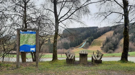
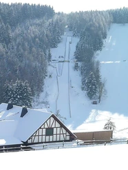
Here is the ski area of SC Rückershausen with the unique winter sports facility in the Siegen-Wittgenstein district, consisting of three ski jumps, a natural ski jump, a mat jump, and a small jumping facility. The F7 leads us over the heights on a natural path towards Birkenhecke (height 659 m).
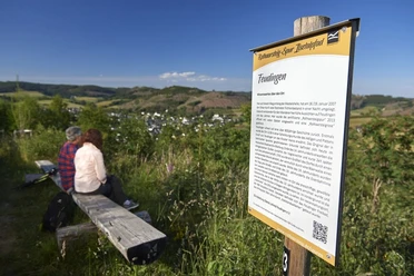
Further along the F7 we hike to Kreuzgrube (height 620 m). The nearby bench offers a magnificent view of the surrounding villages. Now it goes downhill to the Augustenhof forestry house with its Galloway cattle. The F7 then continues towards Weide, passing the nature reserves Eltershausen and Jägerwiese, back to Rückershausen and the end point, the hiking car park at the ski cabin Rückershausen.
Traditionally, a stop at the ski cabin on May 1st as well as for the setting up of the Pentecost tree is worthwhile.
Length of the F7 hiking trail: 10 km.


Waypoints

Good to know
Best to visit
- suitableDepends on weather
Directions
The local hiking trail F7 leads us around the village of Rückershausen with its wonderful ski area, the mountain ridges Birkenhecke (height 659 m) and Weibelskopf (height 620 m).
Start and finish is the hiking car park at the ski cabin in Rückershausen.
Here is the ski area of SC Rückershausen with the unique winter sports facility in the Siegen-Wittgenstein district, consisting of three ski jumps, a natural ski jump, a mat jump, and a small jumping facility. The F7 leads us over the heights on a natural path towards Birkenhecke (height 659 m).
Further along the F7 we hike to Kreuzgrube (height 620 m). The nearby bench offers a magnificent view of the surrounding villages. Now it goes downhill to the Augustenhof forestry house with its Galloway cattle. The F7 then continues towards Weide, passing the nature reserves Eltershausen and Jägerwiese, back to Rückershausen and the end point, the hiking car park at the ski cabin Rückershausen.
Traditionally, a stop at the ski cabin on May 1st as well as for the setting up of the Pentecost tree is worthwhile.
Length of the F7 hiking trail: 10 km.
Tour information
Cultural Interesting
Loop Road
Stop at an Inn
Equipment
- Sturdy and well-broken-in footwear as well as functional, weatherproof, and durable clothing are recommended, as well as a backpack equipped with a small snack and a filled drinking bottle including a rain cover. Of course, a camera should not be missing either.
Directions & Parking facilities
- Getting thereFrom Feudingen by bike or car to Rückershausen to the end of Rückershäuser Street to the hiking car park at the ski cabin. Unfortunately, arrival by public transport is not possible.ParkingHiking car park at the ski cabin in Rückershausen at the end of Rückershäuser StreetPublic transportationUnfortunately, arrival by public transport is not possible.
Additional information
This trail is maintained and marked by the SGV Oberes Lahntal Feudingen e.V.. Various accommodation and dining options can be found on the club's website.
Author
Hans-Joachim Schmidt
Organization
Touristikverband Siegen-Wittgenstein e.V.
License (master data)

Author´s Tip / Recommendation of the author
The Lahntal mat jump at the ski cabin in Rückershausen is definitely recommended.
Traditionally, a stop at the ski cabin on May 1st as well as for the setting up of the Pentecost tree is worthwhile.
Safety guidelines
- Please stay on the marked path. The trail is marked with the trail sign F7.
Nearby



Download GPX file