F9 - Circular hiking trail Oberfischbach-Heisberg


- 2:10 h
- 7.86 km
- 127 m
- 127 m
- 266 m
- 393 m
- 127 m
- Start: Oberfischbach
- Destination: Oberfischbach
Siegerland-Wittgenstein: circular hiking trail
This path not only connects the meadows, fields, and forests around Oberfischbach, Heisberg, and the Lurzenbach near Oberschelden, but also passes the "Grüne Hoffnung" mine in Oberfischbach. A detour to the church in Oberfischbach is recommended.
Trail marking could not yet be completed due to missing posts.


Good to know
Best to visit
Directions
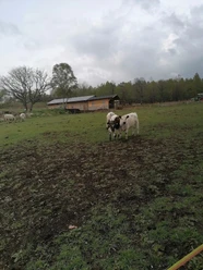
From the specified parking option 1, the F9 (route description clockwise) leads downhill past kindergarten and school with a good view of the church and the village center of Oberfischbach. Although the church is not directly on this hiking trail, a detour to it is worthwhile. From the roundabout, the F9 runs past the old "Grüne Hoffnung" mine and the home of TSV Oberfischbach up the Katzenberg. The path then leads about one and a half kilometers with views past the meadows and fields between Oberfischbach and Heisberg. It continues through a small forest where a resting spot is located. Seven hundred meters after crossing the road, you reach the SGV main hiking trail X19 (Castle Trail from Dillenburg to Düsseldorf). The F9 follows this until above the Siegerland West rest area. Here, it turns right towards Lurzenbach. From the hiking parking lot Lurzenbach, it continues for about nine hundred meters on a meadow path parallel to the paved road up to above Oberschelden. From there, it turns right towards Oberfischbach. The starting point of the hike is reached after about two kilometers through forest and new open areas (bark beetle infestation). On this section, you can also see Heisberg, Kuhlenberg, and the wind turbines on Knippen.
Tour information
Cultural Interesting
Loop Road
Stop at an Inn
Directions & Parking facilities
Parking option 1:
Large-scale parking is possible below the Niederndorf riding facility. Parking coordinates: N50° 51.996' E7° 54.851'
Parking option 2:
Hiking parking lot Lurzenbach, parking coordinates: N50° 52.411' E7° 56.247'
The F9 can be reached directly from the Oberfischbach-Ort bus stop by lines R39 and R40 (pedestrian crossing with zebra stripes in front of the roundabout). The current connections can be determined with the following link:
www.zws-online.de
ZWS = Zweckverband Personennahverkehr Westfalen-Süd
Additional information
Dining option Pieroth in Oberfischbach
Silberkaute 1-3 57258 Freudenberg-Oberfischbach Tel.: 02734 / 4788250
Author
Pauline Coroly
Organization
Stadt Freudenberg
Author´s Tip / Recommendation of the author
Dining option Pieroth in Oberfischbach
Silberkaute 1-3 57258 Freudenberg-Oberfischbach Tel.: 02734 / 4788250
Nearby


Download GPX file