From Siegen to Fischbacherberg


- 1:30 h
- 8.59 km
- 110 m
- 110 m
- 291 m
- 401 m
- 110 m
- Start: Hiking car park above the AHS vocational college
- Destination: Little water house/ Allensteiner Straße (turning point)
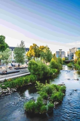
The forest area at Fischbacherberg (371 m above sea level) lies 2 kilometers west of the city center. Partly, the running loop runs over broad paths of the historic Achenbach circular hiking trail, through beech forests, and past the highest point, "Buberg" (380 m above sea level). The presented running loop of 8.3 kilometers crosses the Flowtrail, a mountain bike terrain trail opened in June 2017, several times, which leads down to the Numbach.
The route was developed by the regional running portal "Laufen 57", Frank Steinseifer
Waypoints

Good to know
Best to visit
Directions
The running loop starts at the hiking car park above the AHS vocational college (next to the bus stop "Am Stadtwald"/ Hubertusweg leads a street up to the car park). You start here and run slightly uphill. After 820 meters at the crossroads go straight, after 1.3 kilometers turn right along the wide path, from here it continues flat for one kilometer.
After 2.4 kilometers, run left up the path past the allotment gardens, then turn right at the top onto Allensteiner Straße (2.7 km), after an asphalt section follow the path to the right below the barrier. You run on this path until the 3.9-kilometer mark, at the junction at "Kleinen Buberg" (transmitter) turn left (towards Achenbacher Quelle).
After 4.2 kilometers turn left at the junction, after 200 meters go straight at the fork, then right along the former shooting range. After 4.6 kilometers run left down the gravel path, at kilometer 5 turn left past the large spruce and after 5.2 kilometers sharply left. Shortly after, turn left past the fence of the little water house and back onto Allensteiner Straße (km 5.4). From here you run the same way back to the starting point.
Tour information
Loop Road
Equipment
- Running shoes
- Sportswear
Directions & Parking facilities
By car: hiking car park Laubinger Weg
By train, bus, or long-distance bus from the central bus station ZOB Siegen
From the central bus station ZOB and Siegen main train station, the starting point of the circular route above the vocational college for general trades, home economics, and social pedagogy AHS is directly reachable in about 14 minutes (950 meters).
Alternatively: Bus line C111 from ZOB Siegen
Additional information
The route is also found in the brochure "Running in Siegen". It is available at the Siegen tourist information, telephone 0271 / 404-1316, at Kornmarkt or here for download.
Literature
Author
Dirk Herrmann
Organization
Touristikverband Siegen-Wittgenstein e.V.
License (master data)

Author´s Tip / Recommendation of the author
Safety guidelines
Map
Nearby


Download GPX file