QuellenAcht


- 5:05 h
- 69.52 km
- 857 m
- 857 m
- 285 m
- 659 m
- 374 m
- Start: Bad Laasphe Wilhelmsplatz
- Destination: Bad Laasphe Wilhelmsplatz
The QuellenAcht connects over 70 km Wittgenstein and Siegerland on a route that offers endless possibilities along the way.
Along already existing cycle paths such as the Lahn Cycle Path and the Netpher Cycle Ring, unique landscapes, natural features, and traditional places are passed, showing what the region has to offer.
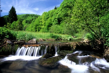
The route’s intersection is in the source area of Sieg, Eder, and Lahn as well as numerous other small springs. The nature here appears lush and rich, almost a little enchanting.
It is not just a bike ride; it is an experience of the region that can be rediscovered again and again.
Entry into the circular route is possible anywhere, and many spots offer a variety of options for individual design.

Waypoints


Good to know
Best to visit
Directions
The Quellenacht is, as the name suggests, a closed circular route that can be started from any point on the route. It is consistently marked with its own logo – a horizontal figure eight. The logo reflects the character of the route. The eight stands for the path layout, which unites one round through Wittgenstein and one round through Siegerland. The intersection of both rounds is the source area around the Sieg and Lahn springs. Deep green stands for abundant nature, fresh blue for the water of the source area, the Obernautalsperre, and the accompanying waters.
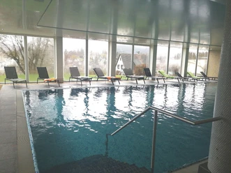
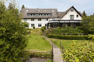
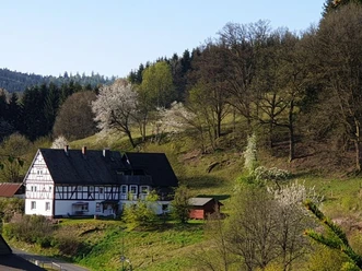
We begin our route in the Lahn town Bad Laasphe. Here there is a wide range of accommodation options from hotels to campsites, enabling stress-free stays before or after the route. Additionally, the old town with its historic half-timbered houses, restaurants, as well as the Bosch craft brewery or the mushroom museum invite you to enjoy the time before and after the route. Our round leads us against the flow direction of the Lahn to its origin, the Lahn spring. For this, starting from Bad Laasphe, we initially consistently follow the signposted Lahn Cycle Path and the Lahn Source Route, which leave the urban area at the height of Friedrichshütte and lead over a level, well-rideable forest path along the young Lahn towards Feudingen. The route initially runs flat; after the first 5 km of the forest path, we reach Wahlbach Mill. Here the owners of the house have created an original rest spot with a drink fridge and cozy seating options inviting a first rest. From here the first slight ascent begins, reaching its peak after 500 m. It continues through forest, meadows, and fields downhill over Feudingen Hut, continuing to Feudingen. Here there is the possibility to stock up on fresh provisions at the supermarket or baker or to take a first longer break with one of the hosts. It continues on an idyllic, flat forest path to Volkholz, a small village at the foot of the mountain that later brings us up to the Lahn spring. The hiking portal Volkholz at the town entrance is reached about 1 km after leaving Feudingen. Here the Hofcafe Dema and a little later the inn of the Volkholz farm shop offer good resting opportunities (observe opening hours) as well as each a farm shop to possibly restock provisions. At the town exit, there is another seating area before it goes through a meadow valley through which the Lahn meanders on the left side. Upon reaching Welschengeheu, a steady ascent to the spring begins, where some elevation over a good two kilometers has to be mastered. At the top we reach junction 25; here we turn right onto the street and see on the left side the country inn Zum Lahnhof. A few meters later on the right side, directly on the Lahn spring, is the hotel-restaurant Forsthaus Lahnquelle. In the adjacent pond the actual Lahn spring originates. We ride another 3 km on Eisenstraße to the Sieg spring. Here we can refill our water bottles with fresh spring water; the spring area has been attractively renatured. Everyone traveling with children can explore a forest educational trail here accompanied by the snail Bythinella. From here, we also recommend a short detour to Großenbach (500 m). The small town offers unique distant views and another dining option, the country inn Zur Siegquelle with a large terrace in the middle of nature. Back at the Sieg spring, we cross the next major intersection (L719), pass junction 18, and follow Eisenstraße towards Netphen. After 4 km at the height of the hiking parking lot Ederquelle (junction 17), it’s worthwhile to take another short break because here we reach a beautiful viewpoint. Also, from here, the Eder spring can be reached (1.2 km). Otherwise, here we turn left off the street towards Forsthaus Hohenroth. After a few meters, on the right side, we see the game reserve and spot Forsthaus Hohenroth with its forest information center. We can refresh ourselves in Café Waldland at Forsthaus Hohenroth. From here, a visit to the Kyrill path is also worthwhile. 200 m behind Forsthaus Hohenroth, wooden benches with a view of the game reserve invite you to pause again before we then ride right down the bike path to the Obernautalsperre. We follow this paved path about 4 km downhill until we catch the first glimpse of the Obernautalsperre. Now it goes continuously along the water. After 2 km, we reach the dam wall with a magnificent view of the Obernautalsperre and the water intake tower. A short ascent leads us up to the parking lot of the reservoir. Ahead on the right hand is now Landhaus Heinrichshöh. Here we follow the winding and steep descent through the residential area. 100 m before the main street (Brauersdorfer Straße) we brake hard and turn left at the height of the playground onto the bike path. After about 1 km, we reach the Netphen leisure park. Here there is an opportunity to use a variety of leisure activities: leisure pool & sauna, fitness & physio, indoor soccer & squash, minigolf facility, trampoline hall, or the new outdoor course. From here, we follow the path between the minigolf course and the building of the former ice stadium, then keep right along the tennis courts until we reach a crossroads after 200 m. There we turn right onto the bike path towards Netphen. After passing a small bridge over the Obernau, we cross on the left the cobblestone old marketplace with the bronze tanner figure. Past the Hotel & Restaurant Stella, we reach Lahnstraße. We follow this right to the junction of the main street (now before us the impressive Catholic church), where we turn left into Bahnhofstraße. On the bridge, we catch a first glimpse of the Sieg. At the end, we cross the bypass road (L729) at the existing traffic lights and turn left into Am Bernstein Street. At the turning loop, we leave the small industrial area behind us and follow the asphalted bike path. After 550 m, we turn right and then immediately left again and follow the bike path towards Deuz – always along the Sieg and through the nature reserve Auenwald until we finally reach the sports field in Deuz after 2.3 km. We go straight into Tannenstraße and turn right at the end onto Waldstraße. This leads us over a slight ascent to the junction Feuersbacher Straße and to junction 40. Officially: At this intersection, we keep left and use the bike path until the next traffic light, running left along the heavily trafficked L729. At the traffic light, we remain on the left side and turn left into Albert-Irle-Straße. On the left side, we now see the Old Station in Deuz and a replica of the first motorized omnibus in the world (Mercedes Benz), which started scheduled service between Deuz and Siegen-Weidenau in 1895. Alternative: Shortly before the junction Feuersbacher Straße, we turn left onto a new bike path that leads you below Feuersbacher Straße across the site of the old station. At the end, you also meet Albert-Irle-Straße. Directly opposite, the Restaurant Firenze and Hotel Ewerts invite you to refresh yourself, as well as the nearby Siegeck Grill and the traditional inn Klein. At the height of the railway tracks, we cross Albert-Irle-Straße at the pedestrian traffic light and ride on Hinterm Wasser street directly towards junction 39 (here there are tracks in the street: risk of falling). From there, it goes right towards Irmgarteichen. We follow the bike path, leave the natural experience pool on the right and reach Salchendorf after 2 km. At the end of the residential area, we turn right onto Albert-Klenner-Straße to then turn left again after about 100 m at the bakery onto the bike path towards Helgersdorf. From the next junction after about 1 km, we always keep right, passing a small seating area on the right side. Shortly after reaching the edge of the forest at the entrance of Helgersdorf, we turn left at the fork to go up the ascent. The bike path now rises slightly up to shortly before Werthenbach and initially leads us above Helgersdorf through open meadows, then through the forest. We reach open fields again and see a residential house. We now roll gently downhill and turn right at the intersection. We cross a small bridge and follow the path along the Gräbener company to the main street (Wetzlarer Straße), where we turn left. We follow the main street for about 500 m and turn right in the sharp left curve shortly after the gas station and turn into Koblenzer Straße towards Irmgarteichen, which leads slightly uphill. After 300 m we reach junction 27. From there it goes left through Im Wiesengrund street towards Hainchen. After 100 m, we turn left again, follow the path past the sports field, later through the residential area to the Kirchweg intersection. Here we turn left and follow the street to the Gießener Straße junction, where we turn right. We pass the Catholic church and ride about 300 m on the main street to junction 26. There we turn left towards the Lahn spring and always follow this bike path. At the top, we almost reach again the intersection of our Quellenacht. Anyone who wants to stop here can simply turn left and reach after about 600m the previously passed dining options. To continue the route without stopping, we turn right towards Heiligenborn and follow this small side street that leads us slightly winding and very idyllically over the valleys of Ilse and Banfe back in the direction of the starting point. At Heiligenborn, a detour to the Ilsequelle is recommended (see author tip). We follow the road course, turning right uphill towards Banfe, passing the hiking parking lot at Indel with an original overnight possibility – the trekking platform, and follow the bike path back to Bad Laasphe. At the Laaspherhütte, there is another opportunity to stop at Dorf Cafe – Gasthof Schmidt (observe opening hours) before returning along the bike path through Weiden back to Bad Laasphe.
Tour information
Cultural Interesting
Loop Road
Stop at an Inn
Equipment
Due to the length of the route, we recommend riding an e-bike. Here, too, the charge level of the batteries should be monitored. There are repeated opportunities to stop for refreshments where, if necessary, the battery can also be charged upon request.
Sufficient drinks and sun protection should be carried along.
Directions & Parking facilities
Depending on the desired entry point into the route, travel is made to the respective town.
An entry into the circular route is possible anywhere.
Bad Laasphe or Feudingen are regularly connected to public transport. The Kurhessenbahn serves both towns hourly. More information can be found here www.kurhessenbahn.de. Bringing a bicycle is possible on every train.
Many other places on the route can be reached by bus, but mostly bicycle transport is not possible there.
Author
Petra Markus
Organization
Touristikverband Siegen-Wittgenstein e.V.
Author´s Tip / Recommendation of the author
A detour to the "Ilsequelle" should not be missed. A small wooden sign near Heiligenborn points the way to the fairy tale hiking trail "Kleiner Rothaar." Here, turn right, first over a paved road until a forest path is reached again. After about 400m, the parking lot at the entrance to the fairy tale hiking trail is reached. Follow the signage of the path; after about 1 km over paths and forest roads, the spring is reached. It is a good place to linger, and bottles can be refilled with the water proven to swirl to the right. Return by bike over the same route.
Nearby


Download GPX file