Rothaarsteig - Access path from Kreuztal


- 4:14 h
- 14.74 km
- 441 m
- 114 m
- 274 m
- 604 m
- 330 m
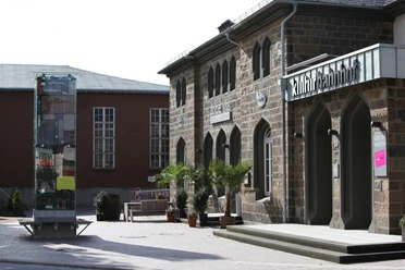
- Start: Kulturbahnhof Kreuztal
- Destination: Ginsberger Heide
At the panoramic bench, which is a bit off the main route, you have an incomparable beautiful view over the Ferndorf valley and the Kindelsberg massif. The section along the "Ruckersfelder Höhe", which is immediately followed by the "Cultural-historical learning path", is also very beautiful. From here it is still a bit further to the Kronprinz oak. And a further uphill section leads to the Ginsberger Heide, where the Hotel-Restaurant Rompf is definitely recommended for a stop. From the Ginsberger Heide, the hike can be continued on the Rothaarsteig.

Waypoints
Good to know
Best to visit
Directions
From the Kulturbahnhof Kreuztal, the route goes through Bahnhofstraße to the fire station and continues through the "Ley". Above the Kreuztal sports field, the path leads to the "Vorm Berge" playground. Follow the hiking signs here until above the equestrian facility "Ferndorfer Mühle". The path then goes uphill and passes the shooting hall on the left while continuing up the hill. Nearby (see information board on site) are impressive hollow ways that were created in the Middle Ages by the transport of iron.
Continue uphill and on the ridge above the drinking water tank to a crossroads where a side path branches off to the panoramic bench at "Kilgeshahn." From there, you have an incomparable beautiful view over the Ferndorf valley, Martinshardt and Kindelsberg. On the further path above Kredenbach, after a slight ascent, old border markers are found. Shortly after, you reach the Wolfsborn spring rest area. The clear water offers a wonderful refreshment for body and mind; a small hut provides shelter. At the crossroads above the spring, go straight on via Siegerberg and Kirberg to the hiking car park "Kredenbacher Höhe." There, cross the country road and hike to "Lichtenhardt" with a picnic island and shelter.
The path continues to the "Herzhäuser Oak" and the hiking car park on the "Allenbacher Höhe" (beware of road crossing). A very beautiful section follows along the "Ruckersfelder Höhe" and a section of the "Cultural-historical learning path" above Grund where the feeder path meets the "Jung-Stilling-Path." From here, it is still a good distance to the Kronprinz oak. Beyond the country road, a steep path leads up to the Ginsberger Heide, where the hike can be continued on the Rothaarsteig.
Places to eat
At the Kulturbahnhof Kreuztal: Restaurant Bar Fünf 10, Pizzeria Da Vinci, Hotel Restaurant Keller
At the Ginsberger Heide: Hotel Restaurant Ginsberger Heide
Tour information
Cultural Interesting
Stop at an Inn
Equipment
Directions & Parking facilities
Additional information
Kreuztal theme trails
- Hauberg trail in the historic Hauberg Fellinghausen
- Nature experience trail Grubengelände Littfeld
- Kindelsberg trail
- ROTHAARSTEIG access path
- Buschhütten iron hammer trail
- Reckhammer meadow trail in Littfeld
- Spring trail Osthelden
Six SGV divisions maintain the approximately 275 km long hiking trail network in Kreuztal: the divisions Littfeld, Krombach, Fellinghausen, Ferndorf-Kreuztal, Kredenbach, and Buschhütten. Guided hikes are regularly offered, and guests are warmly welcome.
Contact
City Kreuztal Tourism
Siegener Str. 3 / 57223 Kreuztal
Phone: 02732/5 14 35 / Fax: 27 91 02 70
Email: stadt_kreuztal@kreuztal.de and m_haeusig@kreuztal.de
Literature
Author
Michael Häusig
Organization
Touristikverband Siegen-Wittgenstein e.V.
License (master data)

Author´s Tip / Recommendation of the author
- Medieval hollow ways above the Ferndorf shooting hall
- View from the panoramic bench
- Rest at the Wolfsborn spring
- Bench between Wolfsborn spring and the Kredenbacher Höhe hiking car park
- Ruckersfelder Höhe
- Cultural-historical learning path Oechelhausen-Ruckersfeld
- Jung-Stilling room Grund
- Ruins of Ginsburg
Safety guidelines
Map
Hiking map Kreuztal, available in regional bookstores and at the city of Kreuztal, €5.00
Cycle and leisure map Siegerland-Wittgenstein with guide booklet, scale 1:50,000, ISBN 3-87073-280-3, €7.95
Nearby


