Rothaarsteig access path from Müsen to the Ferndorfquelle


- 4:10 h
- 14.97 km
- 365 m
- 99 m
- 334 m
- 620 m
- 286 m
- Start: Müsen church
- Destination: Ferndorfquelle
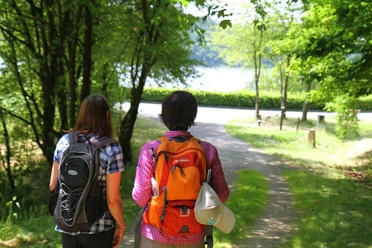
The popular premium hiking trail Rothaarsteig is also accessible from Hilchenbach-Müsen via an access path. Opened in 2017, the access path leads over well-known hiking trails via the Wigrow rest area, the Hilchenbach Höhenring (Hiking Trail of the Year 2018/2020), the Oberndorfer Höhe and finally to the Ferndorfquelle.

Waypoints


Good to know
Best to visit
Directions
You start in the newly redesigned village center at the church in Müsen and follow the hiking signs through Kirchstraße, Wilhelmsstraße, and to Stollenhalde up to the Stahlberg Museum. Here you keep right, then turn left into Glück-Auf-Straße, and after a few meters turn right again into Merklinghäuser Weg. The path goes slightly uphill. At the top, turn right, cross the Winterbach meadow valley, and after a gently ascending path, reach the forest rest and playground "Wigrow." Benches with tables invite you to a first cozy rest here.
From here, the path continues steadily uphill on pleasant forest paths. You come across the Hilchenbach Höhenring and reach the L728 country road, which you cross at the "Parkplatz Oberförsterweg" area. Now you continue a bit further uphill over the Wimberg (600m above sea level) to the "Schartenberg." Here it is worth making a detour to the nearby inn "Zum Hasenbahnhof." A signpost shows you the way.
Back on the Rothaarsteig access path, you hike relaxed until you reach the connecting road between Hilchenbach and Heinsberg. Here you turn left and walk a bit up the paved road until you turn right after about 400m. You are now above the wind park and can repeatedly enjoy the wonderful view towards Hilchenbach and later into the upper Ferndorftal. Between the 4th and 5th wind turbines, you pass a shelter inviting you to another cozy rest. Now you have almost made it. Via the viewpoints "Drei Buchen" and "grüner Platz," you pass the Oberndorfer Höhe hiking car park near Helmut's Rothaar hut, which is operated on weekends. After just under a kilometer, you meet the Rothaarsteig at the Ferndorfquelle.
Return route: You can hike down from the Ferndorfquelle to Helberhausen and on to Hilchenbach (about 5 km) on another Rothaarsteig access path and continue by public transport back to the starting point (check timetables).
Alternatively, follow the Höhenring downhill to Vormwald station (about 4 km - check timetables).
Or: hiking taxi from the Oberndorfer Höhe hiking car park; Ginsberger Heide (Tel. 02733-8358, 0171-1801110)
Tour information
Stop at an Inn
Equipment
Directions & Parking facilities
Additional information
Literature
Author
Susanne Träger
Organization
Stadt Hilchenbach
License (master data)

Author´s Tip / Recommendation of the author
Nearby