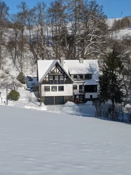
Via Adrina - Wonderful views


- 7:00 h
- 20.81 km
- 550 m
- 550 m
- 362 m
- 542 m
- 180 m
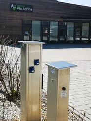
- Start: Entrance portal at the Eder bridge in Arfeld
- Destination: Entrance portal at the Eder bridge in Arfeld
The 20-kilometer-long premium hiking route leads through the varied landscape along the Eder around Arfeld and Schwarzenau. On the approximately six-hour route, you can energetically explore the Eder loops in a figure eight.
The hilly landscape goes up and down many times. You are rewarded on the way with wonderful panoramic views from the heights and adventureously winding natural paths in the valleys.
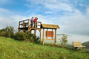
Two viewing platforms set special accents; from there, good "visual connections" to the preceding and upcoming sections of the route are maintained.
The signs with stylized waves indicate the Via Adrina in both directions, which was awarded the third most beautiful hiking trail in Germany in 2009. A well-marked shortcut also makes it possible to divide the circular route into two stages of twelve kilometers each.
Enjoy the tranquility on the extensive route and take a deep breath.


Waypoints


Good to know
Best to visit
Directions
The first stage of the route takes us over the Eder bridge, along a spring area with a group of trees. This is followed by a steep ascent to a viewing platform with a forest rest station, which offers a view over the entire hiking area. The "Cafe Hainbach" is the next stop. We circle the basin of the Mühlbach valley and encounter a herd of the rare Red Wittgenstein Highland cattle. With views towards the Upper Hüttental in Schwarzenau, we continue walking.
We look out over the Magertrift biotope and a pasture with Galloway cattle. We pass former quarries where sandstone was previously extracted for the railway track. After a long descent with wonderful views, we reach the former railway line, which we follow parallel to. We arrive at the "Gästehaus Schwarzenauer Mühle", where we can help ourselves at the garden café.
Just a few meters further, we look at a historic baptismal site: In August 1708, Alexander Mack baptized the first believers in the Eder. This was the founding of the Church of the Brethren, which now has several hundred thousand members worldwide. In immediate vicinity is the Schwarzenau manor house. A long, steep ascent follows into the Hüttental settlement. There is the Alexander Mack Museum. The strenuous climb is rewarded with a second viewing platform and a remarkable view through an eye stone.
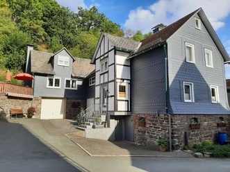
We continue the route and reach the village of Arfeld. A detour to the new "Via Adrina" center with railway worker café and model railway layout is worthwhile here. Directly on the path are the "Alte Schmiede" museum and the important deanery church, which today also serves as a cycling and hiking church. The hiking path leads for a short distance over a cattle track along which cows and goats were driven into the pasture forest. Eventually, we arrive back at our starting point, the old station.
Tour information
Cultural Interesting
Loop Road
Stop at an Inn
Equipment
Directions & Parking facilities
Take the R33 bus from Bad Berleburg station in the direction of Hatzfeld and travel about 15 minutes to the "Arfeld Ederbrücke" stop. You are now directly at the "Via Adrina" entrance portal. The route starts and ends at the same parking lot. The R33 bus line then runs back towards Bad Berleburg station.
Additional information
Tourist Information Bad Berleburg
Marktplatz 1a
57319 Bad Berleburg
Tel. +49 2751 9363-3
Fax +49 2751 9363-43
info@blb-tourismus.de
www.blb-tourismus.de
Literature
Author
BLB-Tourismus GmbH
Organization
BLB-Tourismus GmbH
License (master data)

Author´s Tip / Recommendation of the author
A modern village center has been created from an old industrial wasteland:
"Via Adrina" center with railway worker café and model railway layout
Map
Wittgenstein hiking map: Bad Berleburg with the northern part of Erndtebrück and Bad Laasphe with the southern part of Erndtebrück 10.00 €
ISBN 978-3-86636-940-5
Nearby


Download GPX file